

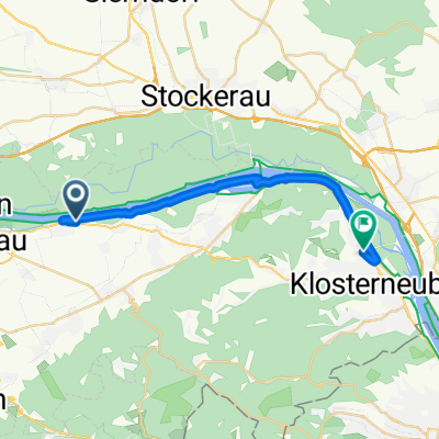
Hängender Stein Strecke
A cycling route starting in Königstetten, Lower Austria, Austria.
Overview
About this route
B14 to St. André before Hagenthale, at the roundabout take the third exit 'Königstetter Str.', continue on 'Im Gebirge' to Wolfpassing. Coming from the west, A1 to exit 'St. Christophen', B19 towards Tulln, at the roundabout take the first exit, at the next roundabout the second exit onto 'Kellerstraße', continue towards Wolfpassing.
- -:--
- Duration
- 19.6 km
- Distance
- 393 m
- Ascent
- 393 m
- Descent
- ---
- Avg. speed
- ---
- Max. altitude

Route quality
Waytypes & surfaces along the route
Waytypes
Track
9.2 km
(47 %)
Road
4.9 km
(25 %)
Surfaces
Paved
10.6 km
(54 %)
Unpaved
5.3 km
(27 %)
Asphalt
10.4 km
(53 %)
Gravel
3.1 km
(16 %)
Continue with Bikemap
Use, edit, or download this cycling route
You would like to ride Hängender Stein Strecke or customize it for your own trip? Here is what you can do with this Bikemap route:
Free features
- Save this route as favorite or in collections
- Copy & plan your own version of this route
- Sync your route with Garmin or Wahoo
Premium features
Free trial for 3 days, or one-time payment. More about Bikemap Premium.
- Navigate this route on iOS & Android
- Export a GPX / KML file of this route
- Create your custom printout (try it for free)
- Download this route for offline navigation
Discover more Premium features.
Get Bikemap PremiumFrom our community
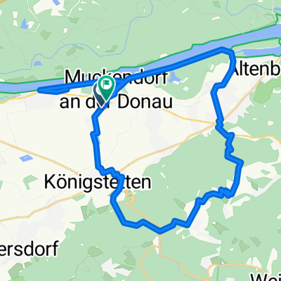
Other popular routes starting in Königstetten
 Mitterweg, Königstetten nach Joseph-Haydn-Gasse, Königstetten
- Distance
- 30 km
- Ascent
- 55 m
- Descent
- 45 m
- Location
- Königstetten, Lower Austria, Austria
 Die Wahnsinnigen am Rad
- Distance
- 33.5 km
- Ascent
- 463 m
- Descent
- 474 m
- Location
- Königstetten, Lower Austria, Austria
 Ufergasse nach Martinstraße
- Distance
- 19.9 km
- Ascent
- 88 m
- Descent
- 51 m
- Location
- Königstetten, Lower Austria, Austria
 Teststrecke Königsstetten Dopplerhütte
- Distance
- 2.9 km
- Ascent
- 231 m
- Descent
- 74 m
- Location
- Königstetten, Lower Austria, Austria
 Wien - Mauerbach - Wipfing - Klosterneuburg
- Distance
- 54.9 km
- Ascent
- 389 m
- Descent
- 390 m
- Location
- Königstetten, Lower Austria, Austria
 Tour de Wienerwald
- Distance
- 21 km
- Ascent
- 313 m
- Descent
- 241 m
- Location
- Königstetten, Lower Austria, Austria
 Muckendorf -Königstetten -Dopplerhütte Hintersdorf-Muckendorf
- Distance
- 36.4 km
- Ascent
- 425 m
- Descent
- 426 m
- Location
- Königstetten, Lower Austria, Austria
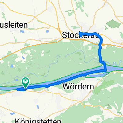 Lale - Stockerau
- Distance
- 35.6 km
- Ascent
- 73 m
- Descent
- 71 m
- Location
- Königstetten, Lower Austria, Austria
Open it in the app