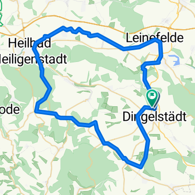
Dingelstädt - Thalwenden
- 36 km
- 224 m
- 251 m
- Dingelstädt, Thuringia, Germany
A cycling route starting in Dingelstädt, Thuringia, Germany.
Overview
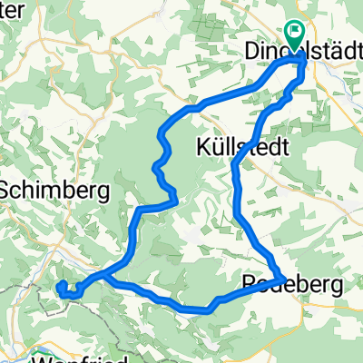
Unpaved only from Kefferhausen to Werdigeshäuser Church
Gleichenstein Castle in a neglected condition; due to the nearby bird breeding, it smells like a stable
all the villages are very beautiful, hardly a house in poor condition (the Eichsfelders love their houses)
very wide view from the Dieteröder Cliffs
from Kallmerode to Dingelstädt it's best to ride next to the road in the forest on the forest path
created this 16 years ago
Continue with Bikemap
You would like to ride Dingelstädt - Gleichenstein - Scharfenstein or customize it for your own trip? Here is what you can do with this Bikemap route:
Free trial for 3 days, or one-time payment. More about Bikemap Premium.
Discover more Premium features.
Get Bikemap PremiumFrom our community
Open it in the app