
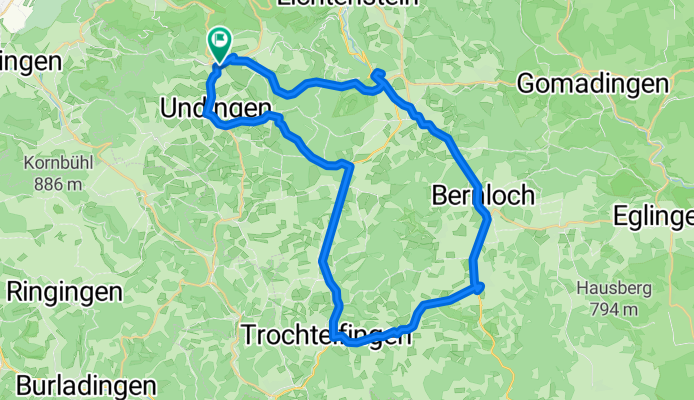
Sonnenbühl-Trochtelfingen-Engstingen-Sonnenbühl
A cycling route starting in Unterhausen, Baden-Wurttemberg, Germany.
Overview
About this route
Wonderful cycling tour, not really easy but still manageable without much effort.
- -:--
- Duration
- 44.3 km
- Distance
- 366 m
- Ascent
- 411 m
- Descent
- ---
- Avg. speed
- 816 m
- Max. altitude
Route quality
Waytypes & surfaces along the route
Waytypes
Track
7.5 km
(17 %)
Road
7.1 km
(16 %)
Surfaces
Paved
38.1 km
(86 %)
Unpaved
4 km
(9 %)
Asphalt
38.1 km
(86 %)
Gravel
1.8 km
(4 %)
Continue with Bikemap
Use, edit, or download this cycling route
You would like to ride Sonnenbühl-Trochtelfingen-Engstingen-Sonnenbühl or customize it for your own trip? Here is what you can do with this Bikemap route:
Free features
- Save this route as favorite or in collections
- Copy & plan your own version of this route
- Sync your route with Garmin or Wahoo
Premium features
Free trial for 3 days, or one-time payment. More about Bikemap Premium.
- Navigate this route on iOS & Android
- Export a GPX / KML file of this route
- Create your custom printout (try it for free)
- Download this route for offline navigation
Discover more Premium features.
Get Bikemap PremiumFrom our community
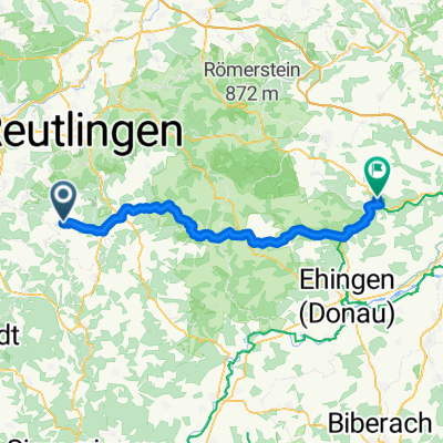
Other popular routes starting in Unterhausen
 Große Burladinger Runde
- Distance
- 97.8 km
- Ascent
- 1,132 m
- Descent
- 1,156 m
- Location
- Unterhausen, Baden-Wurttemberg, Germany
 Entlang der Schwäbischen Alb-Bahn 1. Teil Engstingen -> Münsingen
- Distance
- 19.2 km
- Ascent
- 224 m
- Descent
- 210 m
- Location
- Unterhausen, Baden-Wurttemberg, Germany
 germany-swizz-france-spain
- Distance
- 2,110.7 km
- Ascent
- 6,122 m
- Descent
- 6,041 m
- Location
- Unterhausen, Baden-Wurttemberg, Germany
 über die Alb bis Donaueschingen
- Distance
- 97 km
- Ascent
- 1,073 m
- Descent
- 1,065 m
- Location
- Unterhausen, Baden-Wurttemberg, Germany
 Genkingen-Gomadingen-Hohenstein-Genkingen
- Distance
- 58.3 km
- Ascent
- 522 m
- Descent
- 542 m
- Location
- Unterhausen, Baden-Wurttemberg, Germany
 Große Erbse
- Distance
- 78.3 km
- Ascent
- 766 m
- Descent
- 699 m
- Location
- Unterhausen, Baden-Wurttemberg, Germany
 Sonnenbühl - Blaubeuren
- Distance
- 62.7 km
- Ascent
- 220 m
- Descent
- 510 m
- Location
- Unterhausen, Baden-Wurttemberg, Germany
 Sonnenbühl-Trochtelfingen-Engstingen-Sonnenbühl
- Distance
- 44.3 km
- Ascent
- 366 m
- Descent
- 411 m
- Location
- Unterhausen, Baden-Wurttemberg, Germany
Open it in the app