

Maláj is túra
A cycling route starting in Tököl, Pest County, Hungary.
Overview
About this route
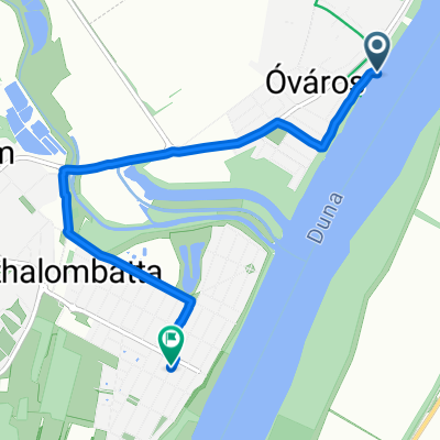
Csepel - Szigetszentmiklós - Szigethalom - Tököl, Halásztelki by the riverside of the Danube.
- -:--
- Duration
- 61.1 km
- Distance
- 21 m
- Ascent
- 24 m
- Descent
- ---
- Avg. speed
- ---
- Max. altitude

Route quality
Waytypes & surfaces along the route
Waytypes
Road
20.8 km
(34 %)
Quiet road
20.2 km
(33 %)
Surfaces
Paved
33.6 km
(55 %)
Unpaved
4.9 km
(8 %)
Asphalt
33.6 km
(55 %)
Ground
3.7 km
(6 %)
Continue with Bikemap
Use, edit, or download this cycling route
You would like to ride Maláj is túra or customize it for your own trip? Here is what you can do with this Bikemap route:
Free features
- Save this route as favorite or in collections
- Copy & plan your own version of this route
- Sync your route with Garmin or Wahoo
Premium features
Free trial for 3 days, or one-time payment. More about Bikemap Premium.
- Navigate this route on iOS & Android
- Export a GPX / KML file of this route
- Create your custom printout (try it for free)
- Download this route for offline navigation
Discover more Premium features.
Get Bikemap PremiumFrom our community
Other popular routes starting in Tököl
 Szent László út 69., Százhalombatta to Római utca 7., Százhalombatta
- Distance
- 4.8 km
- Ascent
- 17 m
- Descent
- 19 m
- Location
- Tököl, Pest County, Hungary
 tököl Vàrós
- Distance
- 0.3 km
- Ascent
- 0 m
- Descent
- 0 m
- Location
- Tököl, Pest County, Hungary
 Bem utca 38, Tököl - Bem utca 38, Tököl
- Distance
- 12.7 km
- Ascent
- 23 m
- Descent
- 24 m
- Location
- Tököl, Pest County, Hungary
 Két híd túrája
- Distance
- 81.6 km
- Ascent
- 34 m
- Descent
- 33 m
- Location
- Tököl, Pest County, Hungary
 Határ utca 1, Százhalombatta to Böszörményi út 42, Budapest
- Distance
- 32.7 km
- Ascent
- 251 m
- Descent
- 186 m
- Location
- Tököl, Pest County, Hungary
 Tököl-Szigetújfalu-Tököl
- Distance
- 13.5 km
- Ascent
- 0 m
- Descent
- 0 m
- Location
- Tököl, Pest County, Hungary
 Tököl-Kőbánya (Martinovics tér)-Örs Vezér tere-Tököl
- Distance
- 60.6 km
- Ascent
- 38 m
- Descent
- 39 m
- Location
- Tököl, Pest County, Hungary
 Maláj is túra
- Distance
- 61.1 km
- Ascent
- 21 m
- Descent
- 24 m
- Location
- Tököl, Pest County, Hungary
Open it in the app