

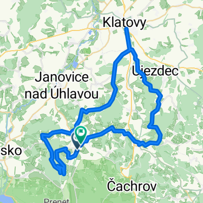
Kunkovice, Zámyšl, Hartmanice - Král Šumavy
A cycling route starting in Strážov, Plzeň Region, Czechia.
Overview
About this route
The more information you write here, the more useful it will be for other users.
- Route progress.
- What is special about this route?
- Why recommend this route?
- What did you like most here?
- Etc.
- -:--
- Duration
- 25.2 km
- Distance
- 533 m
- Ascent
- 556 m
- Descent
- ---
- Avg. speed
- ---
- Max. altitude

Continue with Bikemap
Use, edit, or download this cycling route
You would like to ride Kunkovice, Zámyšl, Hartmanice - Král Šumavy or customize it for your own trip? Here is what you can do with this Bikemap route:
Free features
- Save this route as favorite or in collections
- Copy & plan your own version of this route
- Sync your route with Garmin or Wahoo
Premium features
Free trial for 3 days, or one-time payment. More about Bikemap Premium.
- Navigate this route on iOS & Android
- Export a GPX / KML file of this route
- Create your custom printout (try it for free)
- Download this route for offline navigation
Discover more Premium features.
Get Bikemap PremiumFrom our community
Other popular routes starting in Strážov
 AJ prezentace
- Distance
- 26.5 km
- Ascent
- 344 m
- Descent
- 338 m
- Location
- Strážov, Plzeň Region, Czechia
 Sukacka - Pancir - Zhuri - Sukacka
- Distance
- 44 km
- Ascent
- 860 m
- Descent
- 857 m
- Location
- Strážov, Plzeň Region, Czechia
 Kunkovice, Zámyšl, Hartmanice - Král Šumavy
- Distance
- 25.2 km
- Ascent
- 533 m
- Descent
- 556 m
- Location
- Strážov, Plzeň Region, Czechia
 Sumava: Strazov, Klatovy, Bartolomej, Besiny (2009)
- Distance
- 49.1 km
- Ascent
- 935 m
- Descent
- 944 m
- Location
- Strážov, Plzeň Region, Czechia
 Běšiny,Panciř,Brunst,Prášily,Rejšejtn,Zhůří,Hartmanice,Keple,Běšiny
- Distance
- 148.2 km
- Ascent
- 2,250 m
- Descent
- 2,251 m
- Location
- Strážov, Plzeň Region, Czechia
 Šuac 2011 - Bešiny
- Distance
- 35.4 km
- Ascent
- 538 m
- Descent
- 407 m
- Location
- Strážov, Plzeň Region, Czechia
 Lehom-Miletice-Nýrsko-Lehom
- Distance
- 35.3 km
- Ascent
- 568 m
- Descent
- 567 m
- Location
- Strážov, Plzeň Region, Czechia
 Strážov - Týnec a zpět
- Distance
- 15.3 km
- Ascent
- 299 m
- Descent
- 302 m
- Location
- Strážov, Plzeň Region, Czechia
Open it in the app