

Cihelna - Král Šumavy
A cycling route starting in Sušice, Plzeň Region, Czechia.
Overview
About this route
Čím více zde napíšete informací, tím více bude užitečnější pro ostatním uživatele.* Průběh trasy.* Co je zvláštní na této trase?* Proč doporučit tuto trasu?* Co se Vám zde nejvíce líbilo?* Atd.
- -:--
- Duration
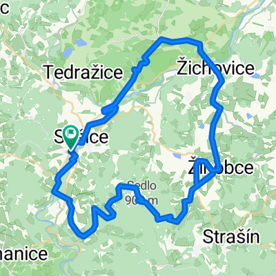
- 4.8 km
- Distance
- 201 m
- Ascent
- 32 m
- Descent
- ---
- Avg. speed
- ---
- Max. altitude

Continue with Bikemap
Use, edit, or download this cycling route
You would like to ride Cihelna - Král Šumavy or customize it for your own trip? Here is what you can do with this Bikemap route:
Free features
- Save this route as favorite or in collections
- Copy & plan your own version of this route
- Sync your route with Garmin or Wahoo
Premium features
Free trial for 3 days, or one-time payment. More about Bikemap Premium.
- Navigate this route on iOS & Android
- Export a GPX / KML file of this route
- Create your custom printout (try it for free)
- Download this route for offline navigation
Discover more Premium features.
Get Bikemap PremiumFrom our community
Other popular routes starting in Sušice
 lehká trasa na rábí (okolí sušice)
- Distance
- 21.4 km
- Ascent
- 222 m
- Descent
- 231 m
- Location
- Sušice, Plzeň Region, Czechia
 20250406 Dlouhá Ves - Svatobor - Sušice pěšky
- Distance
- 10.5 km
- Ascent
- 511 m
- Descent
- 546 m
- Location
- Sušice, Plzeň Region, Czechia
 2016_05_07 Cyklovlak Sušice
- Distance
- 41.6 km
- Ascent
- 367 m
- Descent
- 368 m
- Location
- Sušice, Plzeň Region, Czechia
 Sušice-Platoř - Albrechtice-Žichovice-Sušice
- Distance
- 48.7 km
- Ascent
- 818 m
- Descent
- 813 m
- Location
- Sušice, Plzeň Region, Czechia
 Sušice - Sedlo - okolo Kašperku - Annín - Sušice
- Distance
- 25.8 km
- Ascent
- 511 m
- Descent
- 510 m
- Location
- Sušice, Plzeň Region, Czechia
 Sušice, Hartmanice, Paště, Rejštejn, Annín, Sušice
- Distance
- 36.6 km
- Ascent
- 699 m
- Descent
- 699 m
- Location
- Sušice, Plzeň Region, Czechia
 High point Svatobor cup
- Distance
- 9.6 km
- Ascent
- 357 m
- Descent
- 357 m
- Location
- Sušice, Plzeň Region, Czechia
 Sušice, Rejštejn, Kašperk, Soběšice, Čepice, Sušice
- Distance
- 56.6 km
- Ascent
- 618 m
- Descent
- 618 m
- Location
- Sušice, Plzeň Region, Czechia
Open it in the app