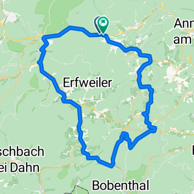
444. "WISSEMBOURG/ COL DU PFAFFENSCHLICK/ JUNGFERNSPRUNG"
A cycling route starting in Hauenstein, Rhineland-Palatinate, Germany.
Overview
About this route
Part 2 'MTT' Palatinate Forest,
ridden on 29.04.2014 desirable: German Wine Gate, Wissembourg (F), Maidenspring near Dahn 'toxic' stings in the eastern foothills- -:--
- Duration
- 116.7 km
- Distance
- 763 m
- Ascent
- 763 m
- Descent
- ---
- Avg. speed
- ---
- Max. altitude
Route quality
Waytypes & surfaces along the route
Waytypes
Road
18.7 km
(16 %)
Cycleway
2.3 km
(2 %)
Surfaces
Paved
95.7 km
(82 %)
Asphalt
94.5 km
(81 %)
Paved (undefined)
1.2 km
(1 %)
Undefined
21 km
(18 %)
Route highlights
Points of interest along the route
Point of interest after 31.6 km
Deutsches Weintor
Point of interest after 94.7 km
Jungfernsprung
Continue with Bikemap
Use, edit, or download this cycling route
You would like to ride 444. "WISSEMBOURG/ COL DU PFAFFENSCHLICK/ JUNGFERNSPRUNG" or customize it for your own trip? Here is what you can do with this Bikemap route:
Free features
- Save this route as favorite or in collections
- Copy & plan your own version of this route
- Split it into stages to create a multi-day tour
- Sync your route with Garmin or Wahoo
Premium features
Free trial for 3 days, or one-time payment. More about Bikemap Premium.
- Navigate this route on iOS & Android
- Export a GPX / KML file of this route
- Create your custom printout (try it for free)
- Download this route for offline navigation
Discover more Premium features.
Get Bikemap PremiumFrom our community
Other popular routes starting in Hauenstein
Burghalder-Weg in Hauenstein- Distance
- 10.9 km
- Ascent
- 347 m
- Descent
- 390 m
- Location
- Hauenstein, Rhineland-Palatinate, Germany
Rundweg über Wernersberg-Annweiler- Distance
- 31 km
- Ascent
- 52 m
- Descent
- 150 m
- Location
- Hauenstein, Rhineland-Palatinate, Germany
Feierabendrunde- Distance
- 14.6 km
- Ascent
- 214 m
- Descent
- 214 m
- Location
- Hauenstein, Rhineland-Palatinate, Germany
Hauenstein - Dahn Jungfernsprung Ausflugsrunde- Distance
- 37.1 km
- Ascent
- 781 m
- Descent
- 777 m
- Location
- Hauenstein, Rhineland-Palatinate, Germany
Hauensteiner Höhenweg- Distance
- 18.5 km
- Ascent
- 441 m
- Descent
- 441 m
- Location
- Hauenstein, Rhineland-Palatinate, Germany
Rundfahrt Wilgartswiesen- Distance
- 12.4 km
- Ascent
- 275 m
- Descent
- 275 m
- Location
- Hauenstein, Rhineland-Palatinate, Germany
Schusterland- Radtour in Hauenstein- Distance
- 62.6 km
- Ascent
- 1,154 m
- Descent
- 1,146 m
- Location
- Hauenstein, Rhineland-Palatinate, Germany
Route 12 simplified- Distance
- 23.2 km
- Ascent
- 651 m
- Descent
- 650 m
- Location
- Hauenstein, Rhineland-Palatinate, Germany
Open it in the app

