

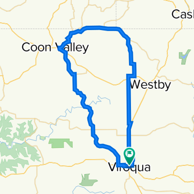
Viroqua Community Bike Ride Long Route
A cycling route starting in Viroqua, Wisconsin, United States.
Overview
About this route
This is the longer version of the Viroqua Community Bike Ride.
- -:--
- Duration
- 13.5 km
- Distance
- 98 m
- Ascent
- 98 m
- Descent
- ---
- Avg. speed
- ---
- Max. altitude
Route quality
Waytypes & surfaces along the route
Waytypes
Quiet road
13.1 km
(97 %)
Access road
0.1 km
(1 %)
Surfaces
Paved
3.5 km
(26 %)
Asphalt
3.5 km
(26 %)
Undefined
10 km
(74 %)
Continue with Bikemap
Use, edit, or download this cycling route
You would like to ride Viroqua Community Bike Ride Long Route or customize it for your own trip? Here is what you can do with this Bikemap route:
Free features
- Save this route as favorite or in collections
- Copy & plan your own version of this route
- Sync your route with Garmin or Wahoo
Premium features
Free trial for 3 days, or one-time payment. More about Bikemap Premium.
- Navigate this route on iOS & Android
- Export a GPX / KML file of this route
- Create your custom printout (try it for free)
- Download this route for offline navigation
Discover more Premium features.
Get Bikemap PremiumFrom our community
Other popular routes starting in Viroqua
 740 N Rusk Ave, Viroqua to N Education Ave, Viroqua
- Distance
- 1.7 km
- Ascent
- 9 m
- Descent
- 7 m
- Location
- Viroqua, Wisconsin, United States
 Viroqua route - short
- Distance
- 53.7 km
- Ascent
- 382 m
- Descent
- 382 m
- Location
- Viroqua, Wisconsin, United States
 Viroqua Community Bike Ride Long Route
- Distance
- 13.5 km
- Ascent
- 98 m
- Descent
- 98 m
- Location
- Viroqua, Wisconsin, United States
 Bud loop
- Distance
- 41.8 km
- Ascent
- 397 m
- Descent
- 400 m
- Location
- Viroqua, Wisconsin, United States
 Upper Kickapoo
- Distance
- 79.8 km
- Ascent
- 750 m
- Descent
- 750 m
- Location
- Viroqua, Wisconsin, United States
 433 W Maple St, Viroqua to 433 W Maple St, Viroqua
- Distance
- 22.3 km
- Ascent
- 221 m
- Descent
- 215 m
- Location
- Viroqua, Wisconsin, United States
 Viroqua Community Bike Ride Regular Route
- Distance
- 11.6 km
- Ascent
- 88 m
- Descent
- 88 m
- Location
- Viroqua, Wisconsin, United States
 750 N Rusk Ave, Viroqua to 800 N Rusk Ave, Viroqua
- Distance
- 0.5 km
- Ascent
- 3 m
- Descent
- 0 m
- Location
- Viroqua, Wisconsin, United States
Open it in the app