a BAJO HONDO
A cycling route starting in Bahía Blanca, Buenos Aires, Argentina.
Overview
About this route
START: Rotonda de Lainez 3100, heading up Av. Rosas, take the road to the airport -- old route 3 -- Upon reaching the bridge that crosses the Naposta Chico or Arroyo Bajo Hondo, cross it and a few meters ahead we find a secondary road (to our right), enter it and follow it until the first right curve (we see a level crossing). Turn there and we are at the old railway station, Pringles line, deactivated. We enter Bajo Hondo and take a road parallel to the Tres Arroyos train line tracks, until we find a railway bridge/tunnel over the tracks. End of the route. A visit to the old station is a must, we pass by it...
- -:--
- Duration
- 34.8 km
- Distance
- 111 m
- Ascent
- 62 m
- Descent
- ---
- Avg. speed
- ---
- Max. altitude
Route highlights
Points of interest along the route

Point of interest after 0 km
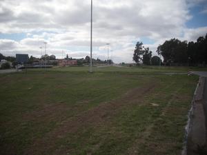
SALIDA DESDE LAINEZ E INDIADA

Point of interest after 28 km
PUENTE CARRETERO SOBRE RUTA 3 VIEJA

Point of interest after 30.7 km
VIAS QUE VIENEN DE LOS FAMOSOS 7 PUENTES FERROVIARIOS.

Point of interest after 32.6 km
EX ESTACION FERROVIARIA EN RUINAS

Point of interest after 33.9 km
ESTACION FERROVIARIA ex DEL SUD

Point of interest after 34.8 km
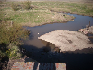
ARROYO BAJO HONDO

Point of interest after 34.8 km
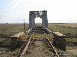
PUENTE FERROVIARIO SOBRE LAS VIAS .. CRUCE DE VIAS. BAJO HONDO
Continue with Bikemap
Use, edit, or download this cycling route
You would like to ride a BAJO HONDO or customize it for your own trip? Here is what you can do with this Bikemap route:
Free features
- Save this route as favorite or in collections
- Copy & plan your own version of this route
- Sync your route with Garmin or Wahoo
Premium features
Free trial for 3 days, or one-time payment. More about Bikemap Premium.
- Navigate this route on iOS & Android
- Export a GPX / KML file of this route
- Create your custom printout (try it for free)
- Download this route for offline navigation
Discover more Premium features.
Get Bikemap PremiumFrom our community
Other popular routes starting in Bahía Blanca
 LOMAS DEL RODEO
- Distance
- 46.6 km
- Ascent
- 110 m
- Descent
- 111 m
- Location
- Bahía Blanca, Buenos Aires, Argentina
 a CABILDO desde La Rotonda del Ciclista
- Distance
- 59.3 km
- Ascent
- 237 m
- Descent
- 104 m
- Location
- Bahía Blanca, Buenos Aires, Argentina
 de BAHIA BLANCA a PICO TRUNCADO
- Distance
- 1,295.6 km
- Ascent
- 1,434 m
- Descent
- 1,177 m
- Location
- Bahía Blanca, Buenos Aires, Argentina
 del CAÑON a SIERRA DE LA VENTANA
- Distance
- 88.4 km
- Ascent
- 405 m
- Descent
- 190 m
- Location
- Bahía Blanca, Buenos Aires, Argentina
 Hormiga, Viticola, Carrindanga
- Distance
- 68.6 km
- Ascent
- 163 m
- Descent
- 166 m
- Location
- Bahía Blanca, Buenos Aires, Argentina
 Quebrada del Indio con Yapa
- Distance
- 124.7 km
- Ascent
- 350 m
- Descent
- 350 m
- Location
- Bahía Blanca, Buenos Aires, Argentina
 Canessa por tierra 1
- Distance
- 33.4 km
- Ascent
- 155 m
- Descent
- 79 m
- Location
- Bahía Blanca, Buenos Aires, Argentina
 VUELTA DE ESPORA
- Distance
- 16.2 km
- Ascent
- 75 m
- Descent
- 65 m
- Location
- Bahía Blanca, Buenos Aires, Argentina
Open it in the app


