

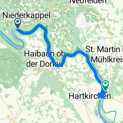
Training 03 Aschachtal
A cycling route starting in Pfarrkirchen im Mühlkreis, Upper Austria, Austria.
Overview
About this route
Engelhartszell, Wesenufer, Haibach, Aschachtal, Waizenkirchen, Eschenau, Waldkirchen, Wesenufer, Engelhartszell
- -:--
- Duration
- 61.2 km
- Distance
- 711 m
- Ascent
- 718 m
- Descent
- ---
- Avg. speed
- ---
- Max. altitude
Continue with Bikemap
Use, edit, or download this cycling route
You would like to ride Training 03 Aschachtal or customize it for your own trip? Here is what you can do with this Bikemap route:
Free features
- Save this route as favorite or in collections
- Copy & plan your own version of this route
- Sync your route with Garmin or Wahoo
Premium features
Free trial for 3 days, or one-time payment. More about Bikemap Premium.
- Navigate this route on iOS & Android
- Export a GPX / KML file of this route
- Create your custom printout (try it for free)
- Download this route for offline navigation
Discover more Premium features.
Get Bikemap PremiumFrom our community
Other popular routes starting in Pfarrkirchen im Mühlkreis
 Route zu Gasthof Luger
- Distance
- 15.2 km
- Ascent
- 413 m
- Descent
- 416 m
- Location
- Pfarrkirchen im Mühlkreis, Upper Austria, Austria
 Deggendorf - Pfarrkirchen im Mühlkreis
- Distance
- 3.5 km
- Ascent
- 39 m
- Descent
- 68 m
- Location
- Pfarrkirchen im Mühlkreis, Upper Austria, Austria
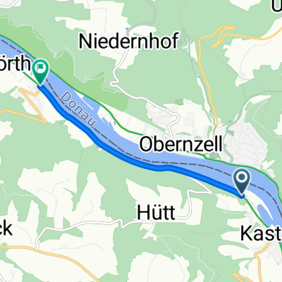
 12.Engelhartszell-Hofkirchen
- Distance
- 60.6 km
- Ascent
- 586 m
- Descent
- 574 m
- Location
- Pfarrkirchen im Mühlkreis, Upper Austria, Austria
 Efteling - Tag 5
- Distance
- 62.4 km
- Ascent
- 183 m
- Descent
- 166 m
- Location
- Pfarrkirchen im Mühlkreis, Upper Austria, Austria
 Pfarrkirchen im Mühlkreis - Feldkirchen an der Donau
- Distance
- 24.5 km
- Ascent
- 650 m
- Descent
- 644 m
- Location
- Pfarrkirchen im Mühlkreis, Upper Austria, Austria
 Teil 7: Von Engelhartszell bis Gallneukirchen
- Distance
- 82.4 km
- Ascent
- 1,349 m
- Descent
- 1,314 m
- Location
- Pfarrkirchen im Mühlkreis, Upper Austria, Austria
 DonauTalMan
- Distance
- 146.1 km
- Ascent
- 3,060 m
- Descent
- 3,055 m
- Location
- Pfarrkirchen im Mühlkreis, Upper Austria, Austria
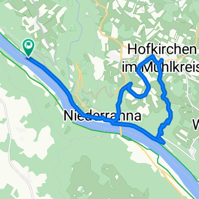
 Donaurunde Obernzell - Niederranna und zurück
- Distance
- 36.8 km
- Ascent
- 286 m
- Descent
- 413 m
- Location
- Pfarrkirchen im Mühlkreis, Upper Austria, Austria
Open it in the app