

Saar-Radweg
A cycling route starting in Sarreguemines, Grand Est, France.
Overview
About this route
track uploaded with updater tool
- -:--
- Duration
- 0.1 km
- Distance
- 0 m
- Ascent
- 0 m
- Descent
- ---
- Avg. speed
- ---
- Max. altitude
Route quality
Waytypes & surfaces along the route
Waytypes
Cycleway
0.1 km
(100 %)
Surfaces
Paved
0.1 km
(100 %)
Asphalt
0.1 km
(100 %)
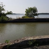
Route highlights
Points of interest along the route

Point of interest after 0.1 km
fspark Werner Freund Der Verhaltensforscher Werner Freund betrieb in diesem Park über 30 Jahre Verhaltensforschung an Wölfen. Er hat in dieser Zeit jeden Wolf mit eigenen Händen groß gezogen und ihren Alltag geteilt und so die Rudel und ihr Verhalten analysiert und verstanden. Aktuell leben insgesam

Point of interest after 0.1 km
klinger Hütte Die Völklinger Hütte ist ein 1873 gegründetes ehemaliges Eisenwerk in der saarländischen Stadt Völklingen. Es wurde 1986 stillgelegt und 1994 erhob die UNESCO die Völklinger Hütte als erstes Industriedenkmal auf der Welt in den Rang eines Weltkulturerbes der Menschheit.
Continue with Bikemap
Use, edit, or download this cycling route
You would like to ride Saar-Radweg or customize it for your own trip? Here is what you can do with this Bikemap route:
Free features
- Save this route as favorite or in collections
- Copy & plan your own version of this route
- Sync your route with Garmin or Wahoo
Premium features
Free trial for 3 days, or one-time payment. More about Bikemap Premium.
- Navigate this route on iOS & Android
- Export a GPX / KML file of this route
- Create your custom printout (try it for free)
- Download this route for offline navigation
Discover more Premium features.
Get Bikemap PremiumFrom our community
Other popular routes starting in Sarreguemines
 Saargemünd - Saarburg
- Distance
- 62.4 km
- Ascent
- 424 m
- Descent
- 381 m
- Location
- Sarreguemines, Grand Est, France
 Saar-Radweg
- Distance
- 108.2 km
- Ascent
- 198 m
- Descent
- 272 m
- Location
- Sarreguemines, Grand Est, France
 140731, 10. Etappe, Sarreguemines-Merzig
- Distance
- 63.7 km
- Ascent
- 107 m
- Descent
- 137 m
- Location
- Sarreguemines, Grand Est, France
 Keskastel, France / Henridorff, France
- Distance
- 68.8 km
- Ascent
- 570 m
- Descent
- 315 m
- Location
- Sarreguemines, Grand Est, France
 Von Saargemünd bis Dolving (Hotel Couvent St Ulrich)
- Distance
- 68.3 km
- Ascent
- 356 m
- Descent
- 269 m
- Location
- Sarreguemines, Grand Est, France
 49.111, 7.074 nach 49.066, 7.114
- Distance
- 10.7 km
- Ascent
- 16 m
- Descent
- 16 m
- Location
- Sarreguemines, Grand Est, France
 saar-radweg
- Distance
- 48 km
- Ascent
- 110 m
- Descent
- 98 m
- Location
- Sarreguemines, Grand Est, France
 Boucles Sarre-Moselle-sarre
- Distance
- 387.8 km
- Ascent
- 1,975 m
- Descent
- 1,979 m
- Location
- Sarreguemines, Grand Est, France
Open it in the app