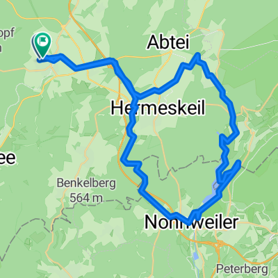
2014 Ruwer Hochwald Bahntrasse Reinsfeld-Hentern
A cycling route starting in Reinsfeld, Rhineland-Palatinate, Germany.
Overview
About this route
und zurück
wetter immer schlechter,4 bis 5 wind,eiskalter gegenwind,aber zum glück bergrunter und also auf dem rückweg fetter rückenwind sieht nach regen aus ,bis mittag hält sichs aber aber der wind ist abartig kalt 5 sterne radweg,runter bis zur mosel,radbus am WE +feiertags+ferien... super geile landschaft- -:--
- Duration
- 20.6 km
- Distance
- 199 m
- Ascent
- 366 m
- Descent
- ---
- Avg. speed
- ---
- Avg. speed
Route quality
Waytypes & surfaces along the route
Waytypes
Path
17.8 km
(86 %)
Cycleway
1 km
(5 %)
Surfaces
Paved
19.3 km
(94 %)
Unpaved
0.8 km
(4 %)
Asphalt
16.1 km
(78 %)
Paved (undefined)
3.2 km
(16 %)
Route highlights
Points of interest along the route
Point of interest after 16.2 km
bahntrasse hier,ist bearbeitet...aber wird wohl nicht ausgebaut werden dieses stück
Point of interest after 16.9 km
pausenplatz an der ruwer
Point of interest after 18.1 km
ab hier wieder bahntrasse
Continue with Bikemap
Use, edit, or download this cycling route
You would like to ride 2014 Ruwer Hochwald Bahntrasse Reinsfeld-Hentern or customize it for your own trip? Here is what you can do with this Bikemap route:
Free features
- Save this route as favorite or in collections
- Copy & plan your own version of this route
- Sync your route with Garmin or Wahoo
Premium features
Free trial for 3 days, or one-time payment. More about Bikemap Premium.
- Navigate this route on iOS & Android
- Export a GPX / KML file of this route
- Create your custom printout (try it for free)
- Download this route for offline navigation
Discover more Premium features.
Get Bikemap PremiumFrom our community
Other popular routes starting in Reinsfeld
- Hochwald Radweg
- Distance
- 42.3 km
- Ascent
- 67 m
- Descent
- 436 m
- Location
- Reinsfeld, Rhineland-Palatinate, Germany
- 2014 Ruwer Hochwald Bahntrasse Reinsfeld-Hentern
- Distance
- 20.6 km
- Ascent
- 199 m
- Descent
- 366 m
- Location
- Reinsfeld, Rhineland-Palatinate, Germany
- Reinsfeld-Rösterkopf-Teufelskopf-Reinsfeld
- Distance
- 43.2 km
- Ascent
- 546 m
- Descent
- 547 m
- Location
- Reinsfeld, Rhineland-Palatinate, Germany
- Singende Tal
- Distance
- 60.6 km
- Ascent
- 811 m
- Descent
- 813 m
- Location
- Reinsfeld, Rhineland-Palatinate, Germany
- Hochwald Radweg
- Distance
- 43.4 km
- Ascent
- 99 m
- Descent
- 461 m
- Location
- Reinsfeld, Rhineland-Palatinate, Germany
- Reinsfeld -Oberlimberg
- Distance
- 71.3 km
- Ascent
- 394 m
- Descent
- 534 m
- Location
- Reinsfeld, Rhineland-Palatinate, Germany
- schnelle Runde Kell
- Distance
- 18.3 km
- Ascent
- 569 m
- Descent
- 570 m
- Location
- Reinsfeld, Rhineland-Palatinate, Germany
- Nonnweiler Stausee
- Distance
- 41 km
- Ascent
- 416 m
- Descent
- 424 m
- Location
- Reinsfeld, Rhineland-Palatinate, Germany
Open it in the app