

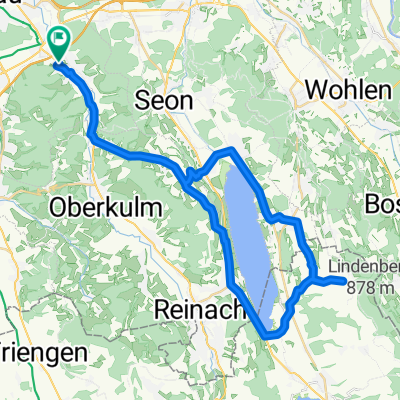
Gränichen-Leutwil-Mosen-Schongau-Boniswil-Leutwil-Gränichen
A cycling route starting in Gränichen, Canton of Aargau, Switzerland.
Overview
About this route
Idyllic road cycling route starting south of Aarau around Lake Hallwyl with views of the Alps
- -:--
- Duration
- 48.5 km
- Distance
- 682 m
- Ascent
- 680 m
- Descent
- ---
- Avg. speed
- ---
- Max. altitude
Route quality
Waytypes & surfaces along the route
Waytypes
Road
21.4 km
(44 %)
Quiet road
5.3 km
(11 %)
Surfaces
Paved
15 km
(31 %)
Unpaved
1.9 km
(4 %)
Asphalt
13.1 km
(27 %)
Paved (undefined)
1.9 km
(4 %)
Route highlights
Points of interest along the route
Point of interest after 24.7 km
Schongiland Kinderspielplatz
Continue with Bikemap
Use, edit, or download this cycling route
You would like to ride Gränichen-Leutwil-Mosen-Schongau-Boniswil-Leutwil-Gränichen or customize it for your own trip? Here is what you can do with this Bikemap route:
Free features
- Save this route as favorite or in collections
- Copy & plan your own version of this route
- Sync your route with Garmin or Wahoo
Premium features
Free trial for 3 days, or one-time payment. More about Bikemap Premium.
- Navigate this route on iOS & Android
- Export a GPX / KML file of this route
- Create your custom printout (try it for free)
- Download this route for offline navigation
Discover more Premium features.
Get Bikemap PremiumFrom our community
Other popular routes starting in Gränichen
 Gränichen-Oberentfelden-Schöftland-Wannenhof-Gränichen
- Distance
- 27.9 km
- Ascent
- 306 m
- Descent
- 305 m
- Location
- Gränichen, Canton of Aargau, Switzerland
 Grä-Schöftland-Rehag-Reinach-Gränichen
- Distance
- 44.3 km
- Ascent
- 493 m
- Descent
- 493 m
- Location
- Gränichen, Canton of Aargau, Switzerland
 RR_2014_Gränichen_8
- Distance
- 42.2 km
- Ascent
- 904 m
- Descent
- 843 m
- Location
- Gränichen, Canton of Aargau, Switzerland
 Gränichen-Schinznach
- Distance
- 15.9 km
- Ascent
- 75 m
- Descent
- 141 m
- Location
- Gränichen, Canton of Aargau, Switzerland
 Gänstelstrasse 29, Gränichen nach Schiffländi 4, Stein am Rhein
- Distance
- 97.4 km
- Ascent
- 1,498 m
- Descent
- 1,516 m
- Location
- Gränichen, Canton of Aargau, Switzerland
 Gränichen-Leutwil-Mosen-Schongau-Boniswil-Leutwil-Gränichen
- Distance
- 48.5 km
- Ascent
- 682 m
- Descent
- 680 m
- Location
- Gränichen, Canton of Aargau, Switzerland
 Anstieg Rütihof
- Distance
- 2.4 km
- Ascent
- 181 m
- Descent
- 14 m
- Location
- Gränichen, Canton of Aargau, Switzerland
 Gränichen- Hunzenschwil-Seon-Liebegg-Gränichen
- Distance
- 20.8 km
- Ascent
- 317 m
- Descent
- 303 m
- Location
- Gränichen, Canton of Aargau, Switzerland
Open it in the app