

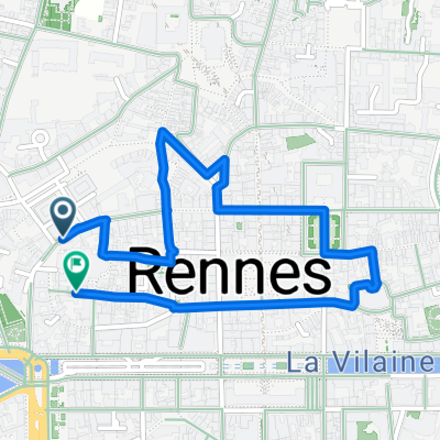
Bretagne Nord - Est (partie 1)
A cycling route starting in Rennes, Brittany Region, France.
Overview
About this route
Departure from Rennes > Canal Ile et Rance to Montreuil du l'Ile > Pontorson > Greenway along the Couesnons > Mont Saint Michel > Duchess Anne's Causeway > Cancale (and its oysters!) Arrival in Saint Malo
- boat from St Malo to Dinard for continuation Northeast Brittany (part 2) from Dinard to Saint Brieuc along the coast
- -:--
- Duration
- 149.6 km
- Distance
- 220 m
- Ascent
- 234 m
- Descent
- ---
- Avg. speed
- ---
- Max. altitude

Route quality
Waytypes & surfaces along the route
Waytypes
Quiet road
37.4 km
(25 %)
Path
25.4 km
(17 %)
Surfaces
Paved
70.3 km
(47 %)
Unpaved
29.9 km
(20 %)
Asphalt
65.8 km
(44 %)
Gravel
19.5 km
(13 %)
Route highlights
Points of interest along the route
Point of interest after 4.9 km
RENNES - vendredi 02 et samedi 03/05/14, camping des Gayeulles
Point of interest after 35.3 km
FEINS - Etang de Boulet - dimanche 04/05/14, camping de La Bijouterie
Point of interest after 80.6 km
BEAUVOIR - lundi 05/05/14, camping aux Pommiers
Point of interest after 138.1 km
SAINT COULOMB - mardi 06/05/14, camping des Chevrêts
Point of interest after 149.6 km
mercredi 07/05/14 Bateau St Malo - Dinard avec nos vélos
Continue with Bikemap
Use, edit, or download this cycling route
You would like to ride Bretagne Nord - Est (partie 1) or customize it for your own trip? Here is what you can do with this Bikemap route:
Free features
- Save this route as favorite or in collections
- Copy & plan your own version of this route
- Split it into stages to create a multi-day tour
- Sync your route with Garmin or Wahoo
Premium features
Free trial for 3 days, or one-time payment. More about Bikemap Premium.
- Navigate this route on iOS & Android
- Export a GPX / KML file of this route
- Create your custom printout (try it for free)
- Download this route for offline navigation
Discover more Premium features.
Get Bikemap PremiumFrom our community
Other popular routes starting in Rennes
 Ida para floresta de Rennes
- Distance
- 33.5 km
- Ascent
- 193 m
- Descent
- 193 m
- Location
- Rennes, Brittany Region, France
 Bretagne Nord - Est (partie 1)
- Distance
- 149.6 km
- Ascent
- 220 m
- Descent
- 234 m
- Location
- Rennes, Brittany Region, France
 Le Moulin Desgués
- Distance
- 12.9 km
- Ascent
- 75 m
- Descent
- 72 m
- Location
- Rennes, Brittany Region, France
 Bretagne Nord - Est (2014)
- Distance
- 278.5 km
- Ascent
- 604 m
- Descent
- 535 m
- Location
- Rennes, Brittany Region, France
 Rennes - Vitré (Google)
- Distance
- 37 km
- Ascent
- 261 m
- Descent
- 217 m
- Location
- Rennes, Brittany Region, France
 BRE-23 Rennes Stadtspaziergang
- Distance
- 2.1 km
- Ascent
- 18 m
- Descent
- 18 m
- Location
- Rennes, Brittany Region, France
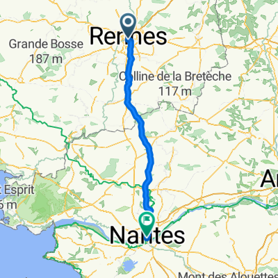 Von Rennes bis Nantes
- Distance
- 117 km
- Ascent
- 858 m
- Descent
- 888 m
- Location
- Rennes, Brittany Region, France
 Rennes - Saint-Domineuc - St Malo
- Distance
- 74.9 km
- Ascent
- 268 m
- Descent
- 302 m
- Location
- Rennes, Brittany Region, France
Open it in the app