

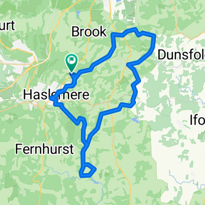
haslemere2 plan
A cycling route starting in Haslemere, England, United Kingdom.
Overview
About this route
zdtybr6nir
- -:--
- Duration
- 35.4 km
- Distance
- 438 m
- Ascent
- 428 m
- Descent
- ---
- Avg. speed
- ---
- Max. altitude

Route quality
Waytypes & surfaces along the route
Waytypes
Cycleway
15.7 km
(44 %)
Quiet road
12.5 km
(35 %)
Surfaces
Paved
2.5 km
(7 %)
Unpaved
3.4 km
(10 %)
Asphalt
2.5 km
(7 %)
Ground
1.8 km
(5 %)
Continue with Bikemap
Use, edit, or download this cycling route
You would like to ride haslemere2 plan or customize it for your own trip? Here is what you can do with this Bikemap route:
Free features
- Save this route as favorite or in collections
- Copy & plan your own version of this route
- Sync your route with Garmin or Wahoo
Premium features
Free trial for 3 days, or one-time payment. More about Bikemap Premium.
- Navigate this route on iOS & Android
- Export a GPX / KML file of this route
- Create your custom printout (try it for free)
- Download this route for offline navigation
Discover more Premium features.
Get Bikemap PremiumFrom our community
Other popular routes starting in Haslemere
 Grayswood and, Haslemere via blackdown
- Distance
- 34.8 km
- Ascent
- 410 m
- Descent
- 404 m
- Location
- Haslemere, England, United Kingdom
 Sim's Grayswood - Hambledon - Chiddingfold - Lurgashall - Haslemere loop
- Distance
- 44.4 km
- Ascent
- 451 m
- Descent
- 451 m
- Location
- Haslemere, England, United Kingdom
 Grayswood To Petworth via Kirdford LOOP
- Distance
- 54.9 km
- Ascent
- 365 m
- Descent
- 365 m
- Location
- Haslemere, England, United Kingdom
 Sim's Grayswood to Petworth via Chiddingfold 40ml Loop
- Distance
- 63.3 km
- Ascent
- 369 m
- Descent
- 370 m
- Location
- Haslemere, England, United Kingdom
 SC Haslemere Godalming Link
- Distance
- 19.1 km
- Ascent
- 189 m
- Descent
- 219 m
- Location
- Haslemere, England, United Kingdom
 LIHC project haslemere > liphook
- Distance
- 25.6 km
- Ascent
- 375 m
- Descent
- 403 m
- Location
- Haslemere, England, United Kingdom
 Lodsworth
- Distance
- 12.1 km
- Ascent
- 118 m
- Descent
- 249 m
- Location
- Haslemere, England, United Kingdom
 Sim’s 30 miles route to Kirdford
- Distance
- 44.2 km
- Ascent
- 261 m
- Descent
- 262 m
- Location
- Haslemere, England, United Kingdom
Open it in the app