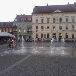
Piła-Trzcianka
A cycling route starting in Piła, Greater Poland Voivodeship, Poland.
Overview
About this route
The route leads through picturesque roads of the towns around Piła. Plenty of ponds, wonderful forests. In Kotunia, we head towards Kłoda/Łomnica and from there to Trzcianka. A lot of descents with views of fields, streams, marshes. Nature in all its glory :) The return journey was supposed to take place via Teresin, Radolin, and Walkowice, but in Walkowice you had to cross the river by ferry - unfortunately, this option is only from 7:00 to 15:00 (it doesn’t operate on weekends), and on the way back it was well past 15:00 ;) Maybe next time we will manage to cross. From Radolin to Biała, cutting across the main road straight to Łomnica. A longer stretch through the forest - beautiful areas. After dark, you can encounter herds of wild boar and timid deer! From Łomnicy to Piła via the original route. The rising moon, and then its full phase illuminated the last kilometers of the route.
- -:--
- Duration
- 66.6 km
- Distance
- 140 m
- Ascent
- 138 m
- Descent
- ---
- Avg. speed
- ---
- Max. altitude
Route quality
Waytypes & surfaces along the route
Waytypes
Road
25.3 km
(38 %)
Quiet road
24 km
(36 %)
Surfaces
Paved
22.7 km
(34 %)
Unpaved
7.3 km
(11 %)
Asphalt
20.7 km
(31 %)
Unpaved (undefined)
7.3 km
(11 %)
Continue with Bikemap
Use, edit, or download this cycling route
You would like to ride Piła-Trzcianka or customize it for your own trip? Here is what you can do with this Bikemap route:
Free features
- Save this route as favorite or in collections
- Copy & plan your own version of this route
- Sync your route with Garmin or Wahoo
Premium features
Free trial for 3 days, or one-time payment. More about Bikemap Premium.
- Navigate this route on iOS & Android
- Export a GPX / KML file of this route
- Create your custom printout (try it for free)
- Download this route for offline navigation
Discover more Premium features.
Get Bikemap PremiumFrom our community
Other popular routes starting in Piła
 BiPi test
- Distance
- 52.9 km
- Ascent
- 201 m
- Descent
- 201 m
- Location
- Piła, Greater Poland Voivodeship, Poland
 Drawskie-Magnetyczna gorka II
- Distance
- 251.8 km
- Ascent
- 528 m
- Descent
- 470 m
- Location
- Piła, Greater Poland Voivodeship, Poland
 byszki 32
- Distance
- 34.6 km
- Ascent
- 94 m
- Descent
- 95 m
- Location
- Piła, Greater Poland Voivodeship, Poland
 dolaszewo
- Distance
- 11.5 km
- Ascent
- 86 m
- Descent
- 84 m
- Location
- Piła, Greater Poland Voivodeship, Poland
 Piła-Trzcianka
- Distance
- 66.6 km
- Ascent
- 140 m
- Descent
- 138 m
- Location
- Piła, Greater Poland Voivodeship, Poland
 Piła-Dobrzyca MTB
- Distance
- 42.4 km
- Ascent
- 130 m
- Descent
- 129 m
- Location
- Piła, Greater Poland Voivodeship, Poland
 Piła - Skrzatusz
- Distance
- 43.2 km
- Ascent
- 176 m
- Descent
- 176 m
- Location
- Piła, Greater Poland Voivodeship, Poland
 Adama Asnyka 1B, Piła do Jana Kochanowskiego 11, Piła
- Distance
- 35.9 km
- Ascent
- 337 m
- Descent
- 374 m
- Location
- Piła, Greater Poland Voivodeship, Poland
Open it in the app


