

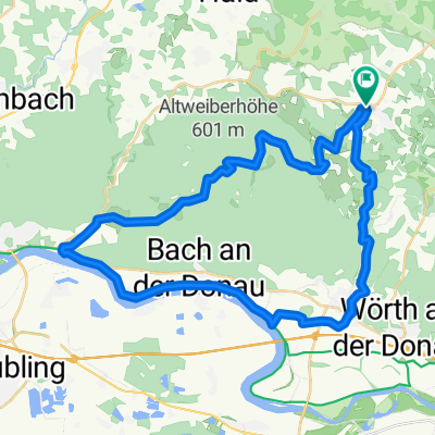
Brennbergrunde_Ost
A cycling route starting in Brennberg, Bavaria, Germany.
Overview
About this route
Test ride start/finish Brennberg heading east
- -:--
- Duration
- 25.3 km
- Distance
- 474 m
- Ascent
- 475 m
- Descent
- ---
- Avg. speed
- ---
- Max. altitude
Route quality
Waytypes & surfaces along the route
Waytypes
Track
15.2 km
(60 %)
Quiet road
8.4 km
(33 %)
Surfaces
Paved
3.5 km
(14 %)
Unpaved
12.7 km
(50 %)
Unpaved (undefined)
4.8 km
(19 %)
Ground
3.5 km
(14 %)
Continue with Bikemap
Use, edit, or download this cycling route
You would like to ride Brennbergrunde_Ost or customize it for your own trip? Here is what you can do with this Bikemap route:
Free features
- Save this route as favorite or in collections
- Copy & plan your own version of this route
- Sync your route with Garmin or Wahoo
Premium features
Free trial for 3 days, or one-time payment. More about Bikemap Premium.
- Navigate this route on iOS & Android
- Export a GPX / KML file of this route
- Create your custom printout (try it for free)
- Download this route for offline navigation
Discover more Premium features.
Get Bikemap PremiumFrom our community
Other popular routes starting in Brennberg
 Brennbergrunde_Ost
- Distance
- 25.3 km
- Ascent
- 474 m
- Descent
- 475 m
- Location
- Brennberg, Bavaria, Germany
 Ebike Tour
- Distance
- 20.5 km
- Ascent
- 396 m
- Descent
- 451 m
- Location
- Brennberg, Bavaria, Germany
 Große Brennbergrunde
- Distance
- 39.5 km
- Ascent
- 585 m
- Descent
- 585 m
- Location
- Brennberg, Bavaria, Germany
 Gfäll-Regensburg
- Distance
- 38.6 km
- Ascent
- 113 m
- Descent
- 375 m
- Location
- Brennberg, Bavaria, Germany
 Auf und Ab im Bayer. Wald
- Distance
- 18 km
- Ascent
- 310 m
- Descent
- 311 m
- Location
- Brennberg, Bavaria, Germany
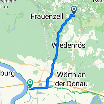 Höllmühle 1, Brennberg to Kiefenholz 12, Wörth an der Donau
- Distance
- 10.2 km
- Ascent
- 92 m
- Descent
- 207 m
- Location
- Brennberg, Bavaria, Germany
 hoch Edik
- Distance
- 34.6 km
- Ascent
- 783 m
- Descent
- 937 m
- Location
- Brennberg, Bavaria, Germany
 Neuhaus Höllbach
- Distance
- 22.3 km
- Ascent
- 539 m
- Descent
- 539 m
- Location
- Brennberg, Bavaria, Germany
Open it in the app