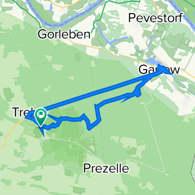
Wendlandrundtour
A cycling route starting in Trebel, Lower Saxony, Germany.
Overview
About this route
Very nice tour. You see a lot of nature and very beautiful and special villages (Lübeln). You can also experience the history of the German division on the tour.
I did the entire route on a road bike and it rode really well, as there are paved cycle paths almost everywhere. Only one forest gravel path near Schwedenschanze was a bit unpleasant, but it couldn't be entirely avoided.
Overall, a nice and varied tour that doesn't demand too much fitness. If you want to stop here and there and take a few longer breaks, you should plan around 4.5 to 5 hours.
- -:--
- Duration
- 94.4 km
- Distance
- 133 m
- Ascent
- 133 m
- Descent
- ---
- Avg. speed
- ---
- Max. altitude
Route quality
Waytypes & surfaces along the route
Waytypes
Road
25.5 km
(27 %)
Quiet road
17.9 km
(19 %)
Surfaces
Paved
40.6 km
(43 %)
Unpaved
12.3 km
(13 %)
Asphalt
33 km
(35 %)
Gravel
7.6 km
(8 %)
Continue with Bikemap
Use, edit, or download this cycling route
You would like to ride Wendlandrundtour or customize it for your own trip? Here is what you can do with this Bikemap route:
Free features
- Save this route as favorite or in collections
- Copy & plan your own version of this route
- Split it into stages to create a multi-day tour
- Sync your route with Garmin or Wahoo
Premium features
Free trial for 3 days, or one-time payment. More about Bikemap Premium.
- Navigate this route on iOS & Android
- Export a GPX / KML file of this route
- Create your custom printout (try it for free)
- Download this route for offline navigation
Discover more Premium features.
Get Bikemap PremiumFrom our community
Other popular routes starting in Trebel
- KLP2016_Tour1_Hoehbeck
- Distance
- 46.7 km
- Ascent
- 145 m
- Descent
- 149 m
- Location
- Trebel, Lower Saxony, Germany
- KLP2009-Pfingstsonntag
- Distance
- 43.4 km
- Ascent
- 75 m
- Descent
- 79 m
- Location
- Trebel, Lower Saxony, Germany
- Wendlandrundtour
- Distance
- 95.3 km
- Ascent
- 121 m
- Descent
- 121 m
- Location
- Trebel, Lower Saxony, Germany
- PGede11
- Distance
- 20 km
- Ascent
- 60 m
- Descent
- 58 m
- Location
- Trebel, Lower Saxony, Germany
- Lanze Gorleben76km
- Distance
- 74.8 km
- Ascent
- 98 m
- Descent
- 97 m
- Location
- Trebel, Lower Saxony, Germany
- Lanze 75km
- Distance
- 75.7 km
- Ascent
- 130 m
- Descent
- 129 m
- Location
- Trebel, Lower Saxony, Germany
- Lüneburg Alternative Torbringen-
- Distance
- 43.9 km
- Ascent
- 154 m
- Descent
- 129 m
- Location
- Trebel, Lower Saxony, Germany
- Wendlandrundtour
- Distance
- 94.4 km
- Ascent
- 133 m
- Descent
- 133 m
- Location
- Trebel, Lower Saxony, Germany
Open it in the app