- 33 km
- 349 m
- 355 m
- Astorga, Paraná, Brazil
ROTA BEIJA-FLOR
A cycling route starting in Astorga, Paraná, Brazil.
Overview
About this route
ASTORGA-FAZ.600ALQ.-CONTORNA O MATINHO-SAI ESTRADA XINGU-DESCE A DIREITA FAZ.POLVANI-SAI NA VENDA PARANAGUA-VIRA A DIREITA DEPOS A ESQUERDA DEST.ESTRADA SUSSUI-PRIMEIRA ENTRADA A ESQUERDA, CONTORNA O MATINHO SENTIDO ESTRADA PARANAGUA NOVAMENTE-CRUZEIRO -NA SOCIEDADE RURAL SOBE A DIREITA-PASSA PESQUEIRO MORINGA GELO, QUEBRA A ESQUERDA SENTIDO ESTAÇÃO COPEL-ASTORGA.
TRAGETO MUITO BONITO FORMATO DE UM BEIJA-FLOR.
- -:--
- Duration
- 34 km
- Distance
- 394 m
- Ascent
- 400 m
- Descent
- ---
- Avg. speed
- ---
- Max. altitude
created this 11 years ago
Continue with Bikemap
Use, edit, or download this cycling route
You would like to ride ROTA BEIJA-FLOR or customize it for your own trip? Here is what you can do with this Bikemap route:
Free features
- Save this route as favorite or in collections
- Copy & plan your own version of this route
- Sync your route with Garmin or Wahoo
Premium features
Free trial for 3 days, or one-time payment. More about Bikemap Premium.
- Navigate this route on iOS & Android
- Export a GPX / KML file of this route
- Create your custom printout (try it for free)
- Download this route for offline navigation
Discover more Premium features.
Get Bikemap PremiumFrom our community
Other popular routes starting in Astorga
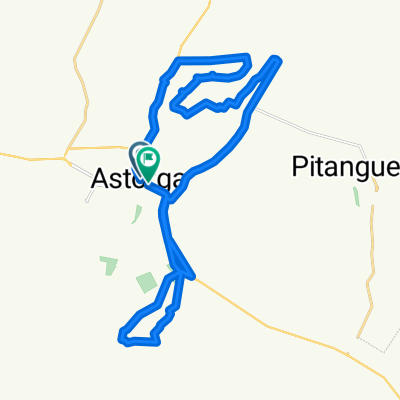
- ROTA 600ALQ./ESTRADA S.JOSÉ
- ROTA BEIJA-FLOR
- 34 km
- 394 m
- 400 m
- Astorga, Paraná, Brazil
- SERRINHA TUPINAMBÁ
- 52.6 km
- 438 m
- 439 m
- Astorga, Paraná, Brazil
- De Rua João Nelson Arcipretti 741 a Rua João Nelson Arcipretti 715
- 15 km
- 108 m
- 114 m
- Astorga, Paraná, Brazil
- ROTA PIPA
- 31.7 km
- 341 m
- 344 m
- Astorga, Paraná, Brazil
- Rede bike - 20km
- 25.3 km
- 289 m
- 289 m
- Astorga, Paraná, Brazil
- ROTA ECOLÓGICA
- 36.2 km
- 442 m
- 442 m
- Astorga, Paraná, Brazil
- ROTA FAZ.600/NIETO
- 32.5 km
- 309 m
- 317 m
- Astorga, Paraná, Brazil
Open it in the app


