

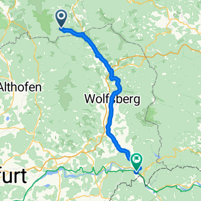
Kathal - Thorl (Trasa2)
A cycling route starting in Obdach, Styria, Austria.
Overview
About this route
Draft route to Vienna (cloned from route 2418490)
- -:--
- Duration
- 94.8 km
- Distance
- 345 m
- Ascent
- 491 m
- Descent
- ---
- Avg. speed
- ---
- Max. altitude

Route quality
Waytypes & surfaces along the route
Waytypes
Cycleway
18 km
(19 %)
Path
4.7 km
(5 %)
Surfaces
Paved
73 km
(77 %)
Asphalt
71.1 km
(75 %)
Paved (undefined)
0.9 km
(1 %)
Continue with Bikemap
Use, edit, or download this cycling route
You would like to ride Kathal - Thorl (Trasa2) or customize it for your own trip? Here is what you can do with this Bikemap route:
Free features
- Save this route as favorite or in collections
- Copy & plan your own version of this route
- Split it into stages to create a multi-day tour
- Sync your route with Garmin or Wahoo
Premium features
Free trial for 3 days, or one-time payment. More about Bikemap Premium.
- Navigate this route on iOS & Android
- Export a GPX / KML file of this route
- Create your custom printout (try it for free)
- Download this route for offline navigation
Discover more Premium features.
Get Bikemap PremiumFrom our community
Other popular routes starting in Obdach
 Obdach - Scheifling
- Distance
- 50.4 km
- Ascent
- 278 m
- Descent
- 386 m
- Location
- Obdach, Styria, Austria
 Von Obdach zum Klopeiner See
- Distance
- 81.3 km
- Ascent
- 586 m
- Descent
- 922 m
- Location
- Obdach, Styria, Austria
 Airpower 2022 mit MTB
- Distance
- 16.8 km
- Ascent
- 56 m
- Descent
- 213 m
- Location
- Obdach, Styria, Austria
 Kathal - Thorl (Trasa2)
- Distance
- 94.8 km
- Ascent
- 345 m
- Descent
- 491 m
- Location
- Obdach, Styria, Austria
 Rudolf-Falb-Gasse 23, Obdach nach Klagenfurterstraße 356, Bad Sankt Leonhard im Lavanttal
- Distance
- 14.2 km
- Ascent
- 114 m
- Descent
- 341 m
- Location
- Obdach, Styria, Austria
 obdach ñach St Paul
- Distance
- 24.2 km
- Ascent
- 11 m
- Descent
- 427 m
- Location
- Obdach, Styria, Austria
 Obdacherhöhe - St. Georgen a.Obdachegg - Kathal - Obdach
- Distance
- 18.1 km
- Ascent
- 397 m
- Descent
- 480 m
- Location
- Obdach, Styria, Austria
 Lavantradweg
- Distance
- 66.2 km
- Ascent
- 24 m
- Descent
- 835 m
- Location
- Obdach, Styria, Austria
Open it in the app