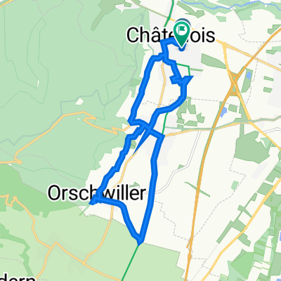
Chatenois-Haut Koenigsbourg-Altenberg
- 39.6 km
- 1,227 m
- 1,224 m
- Châtenois, Grand Est, France
A cycling route starting in Châtenois, Grand Est, France.
Overview
Circuit passing through the valleys of Sainte Marie aux Mines and Kaysersberg with the Col des Bagenelles. Partly on a cycle path.
Route quality
Quiet road
8.6 km
(11 %)
Track
4.7 km
(6 %)
Paved
57.6 km
(74 %)
Asphalt
55.3 km
(71 %)
Paved (undefined)
2.3 km
(3 %)
Undefined
20.2 km
(26 %)
Continue with Bikemap
You would like to ride Chatenois cols Bagenelles le Bonhomme or customize it for your own trip? Here is what you can do with this Bikemap route:
Free trial for 3 days, or one-time payment. More about Bikemap Premium.
Discover more Premium features.
Get Bikemap PremiumFrom our community
Open it in the app