

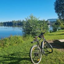
Rund um Kohlberg II
A cycling route starting in Kohlberg, Bavaria, Germany.
Overview
About this route
Notes:
- -:--
- Duration
- 36.9 km
- Distance
- 339 m
- Ascent
- 339 m
- Descent
- ---
- Avg. speed
- ---
- Max. altitude
Route highlights
Points of interest along the route
Point of interest after 7.1 km
Ab hier ist der Weg geschottert
Point of interest after 17.9 km
Der kleine Weg zum Umfahren der Straßensperre
Continue with Bikemap
Use, edit, or download this cycling route
You would like to ride Rund um Kohlberg II or customize it for your own trip? Here is what you can do with this Bikemap route:
Free features
- Save this route as favorite or in collections
- Copy & plan your own version of this route
- Sync your route with Garmin or Wahoo
Premium features
Free trial for 3 days, or one-time payment. More about Bikemap Premium.
- Navigate this route on iOS & Android
- Export a GPX / KML file of this route
- Create your custom printout (try it for free)
- Download this route for offline navigation
Discover more Premium features.
Get Bikemap PremiumFrom our community
Other popular routes starting in Kohlberg
 Rund um Kohlberg II
- Distance
- 36.9 km
- Ascent
- 339 m
- Descent
- 339 m
- Location
- Kohlberg, Bavaria, Germany
 Von Kohlberg über Weiherhammer bis Hirschau
- Distance
- 27.3 km
- Ascent
- 311 m
- Descent
- 346 m
- Location
- Kohlberg, Bavaria, Germany
 Route to Badstraße 13, Schnaittenbach
- Distance
- 8.6 km
- Ascent
- 145 m
- Descent
- 153 m
- Location
- Kohlberg, Bavaria, Germany
 Rund um Kohlberg I
- Distance
- 24.4 km
- Ascent
- 345 m
- Descent
- 345 m
- Location
- Kohlberg, Bavaria, Germany
 freihung
- Distance
- 2.6 km
- Ascent
- 47 m
- Descent
- 0 m
- Location
- Kohlberg, Bavaria, Germany
 Mike I
- Distance
- 35.2 km
- Ascent
- 270 m
- Descent
- 270 m
- Location
- Kohlberg, Bavaria, Germany
 Route nach Hauptstraße 14, Hirschau
- Distance
- 6.5 km
- Ascent
- 93 m
- Descent
- 198 m
- Location
- Kohlberg, Bavaria, Germany
 Neuersdorf 14, Schnaittenbach nach Angerpointstraße 23, Windischeschenbach
- Distance
- 34.1 km
- Ascent
- 310 m
- Descent
- 283 m
- Location
- Kohlberg, Bavaria, Germany
Open it in the app