

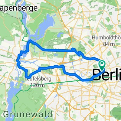
Berlin - Świnoujście
A cycling route starting in Tiergarten, State of Berlin, Germany.
Overview
About this route
Bln - NB - Anklam - Świnoujście
- -:--
- Duration
- 255.3 km
- Distance
- 330 m
- Ascent
- 367 m
- Descent
- ---
- Avg. speed
- ---
- Max. altitude

Route quality
Waytypes & surfaces along the route
Waytypes
Quiet road
46 km
(18 %)
Track
30.6 km
(12 %)
Surfaces
Paved
178.7 km
(70 %)
Unpaved
20.4 km
(8 %)
Asphalt
173.6 km
(68 %)
Unpaved (undefined)
15.3 km
(6 %)
Continue with Bikemap
Use, edit, or download this cycling route
You would like to ride Berlin - Świnoujście or customize it for your own trip? Here is what you can do with this Bikemap route:
Free features
- Save this route as favorite or in collections
- Copy & plan your own version of this route
- Split it into stages to create a multi-day tour
- Sync your route with Garmin or Wahoo
Premium features
Free trial for 3 days, or one-time payment. More about Bikemap Premium.
- Navigate this route on iOS & Android
- Export a GPX / KML file of this route
- Create your custom printout (try it for free)
- Download this route for offline navigation
Discover more Premium features.
Get Bikemap PremiumFrom our community
Other popular routes starting in Tiergarten
 Kleine Parlamentarische Fahrradtour 2018
- Distance
- 8.8 km
- Ascent
- 56 m
- Descent
- 54 m
- Location
- Tiergarten, State of Berlin, Germany
 Hollys-Galeriecafe
- Distance
- 110 km
- Ascent
- 108 m
- Descent
- 111 m
- Location
- Tiergarten, State of Berlin, Germany
 Wannsee round
- Distance
- 70.4 km
- Ascent
- 288 m
- Descent
- 291 m
- Location
- Tiergarten, State of Berlin, Germany
 Seddiner See
- Distance
- 115.4 km
- Ascent
- 229 m
- Descent
- 229 m
- Location
- Tiergarten, State of Berlin, Germany
 Mauerradweg
- Distance
- 171.7 km
- Ascent
- 169 m
- Descent
- 171 m
- Location
- Tiergarten, State of Berlin, Germany
 Spree,Havel und Hohenzollernkanal
- Distance
- 33.2 km
- Ascent
- 35 m
- Descent
- 35 m
- Location
- Tiergarten, State of Berlin, Germany
 Skoda Velothon 2011 60km
- Distance
- 63.9 km
- Ascent
- 0 m
- Descent
- 0 m
- Location
- Tiergarten, State of Berlin, Germany
 Die Route fürs Alleycat/Groupride
- Distance
- 144.4 km
- Ascent
- 304 m
- Descent
- 252 m
- Location
- Tiergarten, State of Berlin, Germany
Open it in the app