

1° TAPPA-- Roma Fumone
A cycling route starting in Valle Santa, Lazio, Italy.
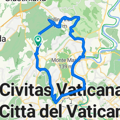
Overview
About this route
<table border="0" cellpadding="0" cellspacing="0" width="951"> <colgroup> <col width="951" /> </colgroup> <tbody> <tr> <td height="20" width="951">
<font size="2">HOTEL IL NIDO D'AQUILA</font> </td> </tr> <tr> <td height="20" width="951"> <font size="2">Provinciale per Ferentino, 14</font> </td> </tr> <tr> <td height="20" width="951"> <font size="2">03010 Fumone</font> </td> </tr> </tbody></table>
- -:--
- Duration
- 124.7 km
- Distance
- 1,332 m
- Ascent
- 880 m
- Descent
- ---
- Avg. speed
- ---
- Max. altitude

Continue with Bikemap
Use, edit, or download this cycling route
You would like to ride 1° TAPPA-- Roma Fumone or customize it for your own trip? Here is what you can do with this Bikemap route:
Free features
- Save this route as favorite or in collections
- Copy & plan your own version of this route
- Split it into stages to create a multi-day tour
- Sync your route with Garmin or Wahoo
Premium features
Free trial for 3 days, or one-time payment. More about Bikemap Premium.
- Navigate this route on iOS & Android
- Export a GPX / KML file of this route
- Create your custom printout (try it for free)
- Download this route for offline navigation
Discover more Premium features.
Get Bikemap PremiumFrom our community
Other popular routes starting in Valle Santa
 Insugherata - Oriolo Romano - Cassia - Corso Francia - Tevere - Monte Ciocci - Monte Mario
- Distance
- 25.8 km
- Ascent
- 242 m
- Descent
- 242 m
- Location
- Valle Santa, Lazio, Italy
 Route 6a: Rom - Campoleone
- Distance
- 53.8 km
- Ascent
- 274 m
- Descent
- 265 m
- Location
- Valle Santa, Lazio, Italy
 Roma - Firenze
- Distance
- 299.4 km
- Ascent
- 2,070 m
- Descent
- 2,118 m
- Location
- Valle Santa, Lazio, Italy
 Selva Candida - Tragliata - Maccarese - Fiumicino
- Distance
- 77.4 km
- Ascent
- 295 m
- Descent
- 295 m
- Location
- Valle Santa, Lazio, Italy
 As Roma Giro Esterno di Roma
- Distance
- 100.1 km
- Ascent
- 406 m
- Descent
- 406 m
- Location
- Valle Santa, Lazio, Italy
 As Roma Morlupo Calcata Campagnano
- Distance
- 126.1 km
- Ascent
- 883 m
- Descent
- 883 m
- Location
- Valle Santa, Lazio, Italy
 ottavia-formello-ottavia
- Distance
- 46.7 km
- Ascent
- 435 m
- Descent
- 478 m
- Location
- Valle Santa, Lazio, Italy
 Selva Nera - Ovindoli
- Distance
- 151.1 km
- Ascent
- 1,900 m
- Descent
- 604 m
- Location
- Valle Santa, Lazio, Italy
Open it in the app