

2 Giorni in Sabina GF Lungo
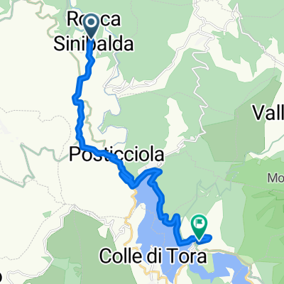
A cycling route starting in Rocca Sinibalda, Lazio, Italy.
Overview
About this route
Long of the Gran Fondo 2 Days of Sabina
- -:--
- Duration
- 140.4 km
- Distance
- 2,084 m
- Ascent
- 2,085 m
- Descent
- ---
- Avg. speed
- ---
- Max. altitude

Route quality
Waytypes & surfaces along the route
Waytypes
Road
91.3 km
(65 %)
Quiet road
4.2 km
(3 %)
Surfaces
Paved
63.2 km
(45 %)
Asphalt
63.2 km
(45 %)
Undefined
77.2 km
(55 %)
Continue with Bikemap
Use, edit, or download this cycling route
You would like to ride 2 Giorni in Sabina GF Lungo or customize it for your own trip? Here is what you can do with this Bikemap route:
Free features
- Save this route as favorite or in collections
- Copy & plan your own version of this route
- Split it into stages to create a multi-day tour
- Sync your route with Garmin or Wahoo
Premium features
Free trial for 3 days, or one-time payment. More about Bikemap Premium.
- Navigate this route on iOS & Android
- Export a GPX / KML file of this route
- Create your custom printout (try it for free)
- Download this route for offline navigation
Discover more Premium features.
Get Bikemap PremiumFrom our community
Other popular routes starting in Rocca Sinibalda
 Giro dei 2 laghi
- Distance
- 105.3 km
- Ascent
- 1,807 m
- Descent
- 1,804 m
- Location
- Rocca Sinibalda, Lazio, Italy
 Rocca Sinibalda-Colle di Tora-Pozzaglia-Orvinio
- Distance
- 42.1 km
- Ascent
- 703 m
- Descent
- 460 m
- Location
- Rocca Sinibalda, Lazio, Italy
 SANBENEDETTO 07 ROCCA SINIBALDA-CASTEL DI TORA
- Distance
- 13.8 km
- Ascent
- 366 m
- Descent
- 338 m
- Location
- Rocca Sinibalda, Lazio, Italy
 C1-2 - ROCCA SINIBALDA - CASTEL DI TORA
- Distance
- 15 km
- Ascent
- 269 m
- Descent
- 235 m
- Location
- Rocca Sinibalda, Lazio, Italy
 15-RoccaSinibalda-Roma
- Distance
- 87.7 km
- Ascent
- 339 m
- Descent
- 883 m
- Location
- Rocca Sinibalda, Lazio, Italy
 2 Giorni in Sabina GF Lungo
- Distance
- 140.4 km
- Ascent
- 2,084 m
- Descent
- 2,085 m
- Location
- Rocca Sinibalda, Lazio, Italy
 Rocca Sinibalda-Teramo
- Distance
- 133.6 km
- Ascent
- 1,453 m
- Descent
- 1,737 m
- Location
- Rocca Sinibalda, Lazio, Italy
 Rocca Sinibalda-Antrodoco-Leonessa-Terminillo-Rocca Sinibalda
- Distance
- 135.8 km
- Ascent
- 1,816 m
- Descent
- 1,842 m
- Location
- Rocca Sinibalda, Lazio, Italy
Open it in the app