

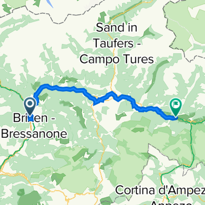
Vahrn-Klausen-Latzfons-Feldthurns-Vahrn
A cycling route starting in Vahrn, Trentino-Alto Adige, Italy.
Overview
About this route
Vahrn-Klausen-Latzfons-Feldthurns-Brixen-Vahrn
- -:--
- Duration
- 43.1 km
- Distance
- 801 m
- Ascent
- 801 m
- Descent
- ---
- Avg. speed
- ---
- Max. altitude
Route quality
Waytypes & surfaces along the route
Waytypes
Quiet road
15.9 km
(37 %)
Road
12.5 km
(29 %)
Surfaces
Paved
31.5 km
(73 %)
Unpaved
0.9 km
(2 %)
Asphalt
27.2 km
(63 %)
Paved (undefined)
4.3 km
(10 %)
Continue with Bikemap
Use, edit, or download this cycling route
You would like to ride Vahrn-Klausen-Latzfons-Feldthurns-Vahrn or customize it for your own trip? Here is what you can do with this Bikemap route:
Free features
- Save this route as favorite or in collections
- Copy & plan your own version of this route
- Sync your route with Garmin or Wahoo
Premium features
Free trial for 3 days, or one-time payment. More about Bikemap Premium.
- Navigate this route on iOS & Android
- Export a GPX / KML file of this route
- Create your custom printout (try it for free)
- Download this route for offline navigation
Discover more Premium features.
Get Bikemap PremiumFrom our community
Other popular routes starting in Vahrn
 PSC 09 Brixen - Trento – Calceranica al Lago (Lago di Caldonazzo)
- Distance
- 128.5 km
- Ascent
- 519 m
- Descent
- 721 m
- Location
- Vahrn, Trentino-Alto Adige, Italy
 Vahrn-Klausen-Latzfons-Feldthurns-Vahrn
- Distance
- 43.1 km
- Ascent
- 801 m
- Descent
- 801 m
- Location
- Vahrn, Trentino-Alto Adige, Italy
 Quälix-Hausstrecke Vahrn-Spiluck
- Distance
- 13.3 km
- Ascent
- 927 m
- Descent
- 798 m
- Location
- Vahrn, Trentino-Alto Adige, Italy
 Špagetárium 2014 den 1
- Distance
- 161.7 km
- Ascent
- 3,999 m
- Descent
- 3,636 m
- Location
- Vahrn, Trentino-Alto Adige, Italy
 Haustrecke Vahrn-Schalders klein
- Distance
- 19.3 km
- Ascent
- 935 m
- Descent
- 935 m
- Location
- Vahrn, Trentino-Alto Adige, Italy
 Vahrn-Spinges-Vals-Mühlbach-Vahrn
- Distance
- 49.4 km
- Ascent
- 1,429 m
- Descent
- 1,429 m
- Location
- Vahrn, Trentino-Alto Adige, Italy
 Moderate Route in Brixen
- Distance
- 7.3 km
- Ascent
- 332 m
- Descent
- 458 m
- Location
- Vahrn, Trentino-Alto Adige, Italy
 ITAT_Alpentour_Tag1_brixen_niederdorf
- Distance
- 60.4 km
- Ascent
- 1,310 m
- Descent
- 799 m
- Location
- Vahrn, Trentino-Alto Adige, Italy
Open it in the app