
VBS
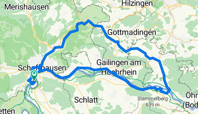
A cycling route starting in Flurlingen, Canton of Zurich, Switzerland.
Overview
About this route
28.05.14 11:44
- -:--
- Duration
- 50.7 km
- Distance
- 218 m
- Ascent
- 214 m
- Descent
- ---
- Avg. speed
- ---
- Max. altitude
Route quality
Waytypes & surfaces along the route
Waytypes
Track
11.7 km
(23 %)
Quiet road
9.6 km
(19 %)
Surfaces
Paved
42.1 km
(83 %)
Unpaved
3.6 km
(7 %)
Asphalt
41.1 km
(81 %)
Gravel
2.5 km
(5 %)
Continue with Bikemap
Use, edit, or download this cycling route
You would like to ride VBS or customize it for your own trip? Here is what you can do with this Bikemap route:
Free features
- Save this route as favorite or in collections
- Copy & plan your own version of this route
- Sync your route with Garmin or Wahoo
Premium features
Free trial for 3 days, or one-time payment. More about Bikemap Premium.
- Navigate this route on iOS & Android
- Export a GPX / KML file of this route
- Create your custom printout (try it for free)
- Download this route for offline navigation
Discover more Premium features.
Get Bikemap PremiumFrom our community
Other popular routes starting in Flurlingen
 20140915 Schaffhausen-Radolfzell-Schaffhausen
- Distance
- 82.7 km
- Ascent
- 760 m
- Descent
- 760 m
- Location
- Flurlingen, Canton of Zurich, Switzerland
 Schaffhausen - Rheinau dem Rhein entlang
- Distance
- 22.4 km
- Ascent
- 280 m
- Descent
- 280 m
- Location
- Flurlingen, Canton of Zurich, Switzerland
 Flur-Oetwil am See einfach (BH)
- Distance
- 96.1 km
- Ascent
- 877 m
- Descent
- 780 m
- Location
- Flurlingen, Canton of Zurich, Switzerland
 Schinerberg-Üsslingen (BH)
- Distance
- 91.6 km
- Ascent
- 832 m
- Descent
- 832 m
- Location
- Flurlingen, Canton of Zurich, Switzerland
 Schaffhausen - Hohentengen
- Distance
- 63.8 km
- Ascent
- 339 m
- Descent
- 336 m
- Location
- Flurlingen, Canton of Zurich, Switzerland
 Steinam Rhein - Weinland (BH)
- Distance
- 60.3 km
- Ascent
- 513 m
- Descent
- 514 m
- Location
- Flurlingen, Canton of Zurich, Switzerland
 Wolfis-Zeitfahrrunde
- Distance
- 38.8 km
- Ascent
- 449 m
- Descent
- 449 m
- Location
- Flurlingen, Canton of Zurich, Switzerland
 Flur-Andelfingen (BH)
- Distance
- 19.5 km
- Ascent
- 116 m
- Descent
- 536 m
- Location
- Flurlingen, Canton of Zurich, Switzerland
Open it in the app