

észak és dél
A cycling route starting in Gönc, Borsod-Abauj Zemplen county, Hungary.
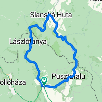
Overview
About this route
Magyarország legészakibb és legdélibb pontja közötti biciklitúra
- -:--
- Duration
- 474.8 km
- Distance
- 237 m
- Ascent
- 450 m
- Descent
- ---
- Avg. speed
- ---
- Max. altitude
Continue with Bikemap
Use, edit, or download this cycling route
You would like to ride észak és dél or customize it for your own trip? Here is what you can do with this Bikemap route:
Free features
- Save this route as favorite or in collections
- Copy & plan your own version of this route
- Split it into stages to create a multi-day tour
- Sync your route with Garmin or Wahoo
Premium features
Free trial for 3 days, or one-time payment. More about Bikemap Premium.
- Navigate this route on iOS & Android
- Export a GPX / KML file of this route
- Create your custom printout (try it for free)
- Download this route for offline navigation
Discover more Premium features.
Get Bikemap PremiumFrom our community
Other popular routes starting in Gönc
 Kő-kapu Kerek-kő- István-kút Kőkapu
- Distance
- 23.9 km
- Ascent
- 434 m
- Descent
- 432 m
- Location
- Gönc, Borsod-Abauj Zemplen county, Hungary
 12.31 Zemplén kör 2022
- Distance
- 20.7 km
- Ascent
- 198 m
- Descent
- 481 m
- Location
- Gönc, Borsod-Abauj Zemplen county, Hungary
 Múzeum út 8a., Telkibánya to Múzeum út 11., Telkibánya
- Distance
- 37.7 km
- Ascent
- 970 m
- Descent
- 980 m
- Location
- Gönc, Borsod-Abauj Zemplen county, Hungary
 Füzér-Nagy Milic - Füzér kör
- Distance
- 15.3 km
- Ascent
- 587 m
- Descent
- 596 m
- Location
- Gönc, Borsod-Abauj Zemplen county, Hungary
 Füzér, Izra-tó, Szalánchuta, Lászlótanya kör
- Distance
- 22.5 km
- Ascent
- 636 m
- Descent
- 636 m
- Location
- Gönc, Borsod-Abauj Zemplen county, Hungary
 STEREO 10.3 Kőkapu - Ördög völgy - Gerendás Rétig
- Distance
- 10.3 km
- Ascent
- 351 m
- Descent
- 146 m
- Location
- Gönc, Borsod-Abauj Zemplen county, Hungary
 Telkibánya 38 km-es kör
- Distance
- 37.8 km
- Ascent
- 559 m
- Descent
- 559 m
- Location
- Gönc, Borsod-Abauj Zemplen county, Hungary
 Zemplén 2014.
- Distance
- 70.8 km
- Ascent
- 1,338 m
- Descent
- 1,338 m
- Location
- Gönc, Borsod-Abauj Zemplen county, Hungary
Open it in the app