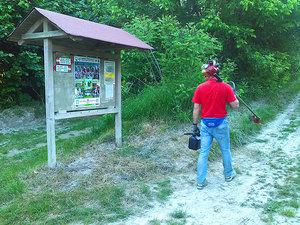
Bike Tribe Mtb Trail
A cycling route starting in Talponada, Veneto, Italy.
Overview
About this route
The mtb trail near the Piave river has been realized by the local mtb team Bike Tribe. The trail start from the famous "Casa delle Fate" of the writer Goffredo Parise till the border with the Venice County. Bikers, runners can use it to arrive till the Adriatic Sea in Jesolo Cortellazzo. Detailed map can be request to info@biketribe.com
- -:--
- Duration
- 7.4 km
- Distance
- 4 m
- Ascent
- 4 m
- Descent
- ---
- Avg. speed
- ---
- Max. altitude
Route highlights
Points of interest along the route

Point of interest after 7.4 km
Oasi di Chiesavecchia Natural Park
Continue with Bikemap
Use, edit, or download this cycling route
You would like to ride Bike Tribe Mtb Trail or customize it for your own trip? Here is what you can do with this Bikemap route:
Free features
- Save this route as favorite or in collections
- Copy & plan your own version of this route
- Sync your route with Garmin or Wahoo
Premium features
Free trial for 3 days, or one-time payment. More about Bikemap Premium.
- Navigate this route on iOS & Android
- Export a GPX / KML file of this route
- Create your custom printout (try it for free)
- Download this route for offline navigation
Discover more Premium features.
Get Bikemap PremiumFrom our community
Other popular routes starting in Talponada
 Bike Tribe Mtb Trail
- Distance
- 7.4 km
- Ascent
- 4 m
- Descent
- 4 m
- Location
- Talponada, Veneto, Italy
 Lengthy bike tour through Salgareda
- Distance
- 33.3 km
- Ascent
- 23 m
- Descent
- 22 m
- Location
- Talponada, Veneto, Italy
 Afternoon Ride
- Distance
- 90.8 km
- Ascent
- 404 m
- Descent
- 261 m
- Location
- Talponada, Veneto, Italy
 casa lavoro
- Distance
- 19.5 km
- Ascent
- 15 m
- Descent
- 13 m
- Location
- Talponada, Veneto, Italy
 un giro in veneto
- Distance
- 127 km
- Ascent
- 361 m
- Descent
- 361 m
- Location
- Talponada, Veneto, Italy
 un giro in veneto
- Distance
- 126.9 km
- Ascent
- 361 m
- Descent
- 361 m
- Location
- Talponada, Veneto, Italy
 Da Ä„˛ˆ? a Ä„˛ˆ?
- Distance
- 19.3 km
- Ascent
- 4 m
- Descent
- 9 m
- Location
- Talponada, Veneto, Italy
 GH25 Lungo_finale-21609775
- Distance
- 123.1 km
- Ascent
- 133 m
- Descent
- 135 m
- Location
- Talponada, Veneto, Italy
Open it in the app

