

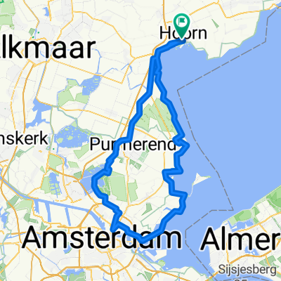
Rondje Markermeer vanuit Hoorn
A cycling route starting in Hoorn, North Holland, The Netherlands.
Overview
About this route
From Hoorn via Amsterdam and Almere to Lelystad and back to Hoorn via Enkhuizen
- -:--
- Duration
- 146.3 km
- Distance
- 10 m
- Ascent
- 10 m
- Descent
- ---
- Avg. speed
- ---
- Max. altitude
Continue with Bikemap
Use, edit, or download this cycling route
You would like to ride Rondje Markermeer vanuit Hoorn or customize it for your own trip? Here is what you can do with this Bikemap route:
Free features
- Save this route as favorite or in collections
- Copy & plan your own version of this route
- Split it into stages to create a multi-day tour
- Sync your route with Garmin or Wahoo
Premium features
Free trial for 3 days, or one-time payment. More about Bikemap Premium.
- Navigate this route on iOS & Android
- Export a GPX / KML file of this route
- Create your custom printout (try it for free)
- Download this route for offline navigation
Discover more Premium features.
Get Bikemap PremiumFrom our community
Other popular routes starting in Hoorn
 Rondje Markermeer vanuit Hoorn
- Distance
- 146.3 km
- Ascent
- 10 m
- Descent
- 10 m
- Location
- Hoorn, North Holland, The Netherlands
 Tag 2_Hoorn-Enkhuizen_Rote Route
- Distance
- 18.9 km
- Ascent
- 0 m
- Descent
- 4 m
- Location
- Hoorn, North Holland, The Netherlands
 Blokdijk to Enkhuizen
- Distance
- 13.1 km
- Ascent
- 6 m
- Descent
- 8 m
- Location
- Hoorn, North Holland, The Netherlands
 De Hulk to Blokdijk
- Distance
- 14.5 km
- Ascent
- 6 m
- Descent
- 11 m
- Location
- Hoorn, North Holland, The Netherlands
 Hoorn-Amsterdam
- Distance
- 100.9 km
- Ascent
- 8 m
- Descent
- 8 m
- Location
- Hoorn, North Holland, The Netherlands
 Rondje Wognum
- Distance
- 36.4 km
- Ascent
- 0 m
- Descent
- 0 m
- Location
- Hoorn, North Holland, The Netherlands
 23-7 rondje met Vincent
- Distance
- 39.7 km
- Ascent
- 0 m
- Descent
- 0 m
- Location
- Hoorn, North Holland, The Netherlands
 43km met Daan
- Distance
- 42.6 km
- Ascent
- 0 m
- Descent
- 0 m
- Location
- Hoorn, North Holland, The Netherlands
Open it in the app