
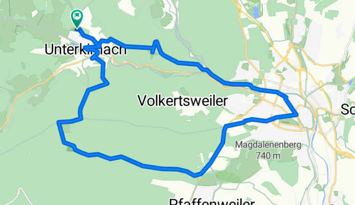
Unterkirnach - Auerhahn - Villingen - Unterkirnach
A cycling route starting in Unterkirnach, Baden-Wurttemberg, Germany.
Overview
About this route
Loop route
- -:--
- Duration
- 23.7 km
- Distance
- 324 m
- Ascent
- 324 m
- Descent
- ---
- Avg. speed
- ---
- Max. altitude

Continue with Bikemap
Use, edit, or download this cycling route
You would like to ride Unterkirnach - Auerhahn - Villingen - Unterkirnach or customize it for your own trip? Here is what you can do with this Bikemap route:
Free features
- Save this route as favorite or in collections
- Copy & plan your own version of this route
- Sync your route with Garmin or Wahoo
Premium features
Free trial for 3 days, or one-time payment. More about Bikemap Premium.
- Navigate this route on iOS & Android
- Export a GPX / KML file of this route
- Create your custom printout (try it for free)
- Download this route for offline navigation
Discover more Premium features.
Get Bikemap PremiumFrom our community
Other popular routes starting in Unterkirnach
 Salvest-Breitbrunnen
- Distance
- 6.7 km
- Ascent
- 171 m
- Descent
- 171 m
- Location
- Unterkirnach, Baden-Wurttemberg, Germany
 Unterkirnach Auerhahn Salvest
- Distance
- 11.3 km
- Ascent
- 249 m
- Descent
- 249 m
- Location
- Unterkirnach, Baden-Wurttemberg, Germany
 Geplante Waldroute
- Distance
- 23 km
- Ascent
- 287 m
- Descent
- 246 m
- Location
- Unterkirnach, Baden-Wurttemberg, Germany
 Große Runde von VS sind es 89 Km
- Distance
- 78.9 km
- Ascent
- 951 m
- Descent
- 1,053 m
- Location
- Unterkirnach, Baden-Wurttemberg, Germany
 VS - Hornberg - Rensberg - Linach
- Distance
- 94.1 km
- Ascent
- 1,126 m
- Descent
- 1,125 m
- Location
- Unterkirnach, Baden-Wurttemberg, Germany
 Pfaffenweiler - Schwärzenbach - Linach
- Distance
- 69 km
- Ascent
- 704 m
- Descent
- 702 m
- Location
- Unterkirnach, Baden-Wurttemberg, Germany
 verdun 2014
- Distance
- 386.4 km
- Ascent
- 1,647 m
- Descent
- 2,084 m
- Location
- Unterkirnach, Baden-Wurttemberg, Germany
 Unterkirnach - Auerhahn - Villingen - Unterkirnach
- Distance
- 23.7 km
- Ascent
- 324 m
- Descent
- 324 m
- Location
- Unterkirnach, Baden-Wurttemberg, Germany
Open it in the app