

Salzkammergutradweg Teil 2
A cycling route starting in Aurach am Hongar, Upper Austria, Austria.
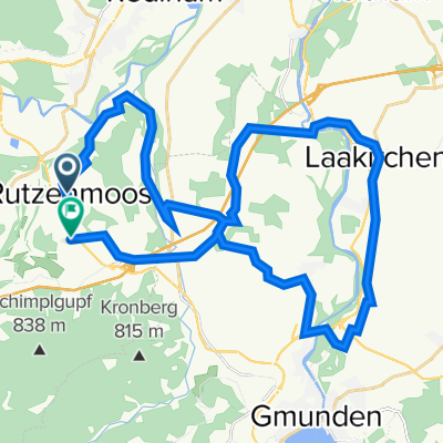
Overview
About this route
Salzkammergut Cycle Path Part 2
Aurach - Attersee - Mondsee - Irrsee - Straßwalchen - Mattsee - Anthering - Salzach - Salzburg (cloned from route 2629074)- -:--
- Duration
- 112.4 km
- Distance
- 549 m
- Ascent
- 616 m
- Descent
- ---
- Avg. speed
- ---
- Max. altitude
Route quality
Waytypes & surfaces along the route
Waytypes
Quiet road
52.8 km
(47 %)
Road
14.6 km
(13 %)
Surfaces
Paved
47.2 km
(42 %)
Unpaved
9 km
(8 %)
Asphalt
46.1 km
(41 %)
Gravel
6.7 km
(6 %)
Continue with Bikemap
Use, edit, or download this cycling route
You would like to ride Salzkammergutradweg Teil 2 or customize it for your own trip? Here is what you can do with this Bikemap route:
Free features
- Save this route as favorite or in collections
- Copy & plan your own version of this route
- Split it into stages to create a multi-day tour
- Sync your route with Garmin or Wahoo
Premium features
Free trial for 3 days, or one-time payment. More about Bikemap Premium.
- Navigate this route on iOS & Android
- Export a GPX / KML file of this route
- Create your custom printout (try it for free)
- Download this route for offline navigation
Discover more Premium features.
Get Bikemap PremiumFrom our community
Other popular routes starting in Aurach am Hongar
 Quer durchs Salzkammergut CLONED FROM ROUTE 1601634
- Distance
- 85.5 km
- Ascent
- 2,532 m
- Descent
- 2,532 m
- Location
- Aurach am Hongar, Upper Austria, Austria
 Quer durchs Salzkammergut
- Distance
- 88.5 km
- Ascent
- 2,476 m
- Descent
- 2,477 m
- Location
- Aurach am Hongar, Upper Austria, Austria
 Laakirchen Runde
- Distance
- 36.3 km
- Ascent
- 495 m
- Descent
- 577 m
- Location
- Aurach am Hongar, Upper Austria, Austria
 Timelkam Gampern Aurach
- Distance
- 36.7 km
- Ascent
- 354 m
- Descent
- 361 m
- Location
- Aurach am Hongar, Upper Austria, Austria
 Route nach B120 2, Gmunden
- Distance
- 14.9 km
- Ascent
- 361 m
- Descent
- 725 m
- Location
- Aurach am Hongar, Upper Austria, Austria
 Fisch Lambach Waldweg
- Distance
- 38.8 km
- Ascent
- 596 m
- Descent
- 689 m
- Location
- Aurach am Hongar, Upper Austria, Austria
 Langsame Fahrt in Aurach am Hongar
- Distance
- 9.8 km
- Ascent
- 125 m
- Descent
- 120 m
- Location
- Aurach am Hongar, Upper Austria, Austria
 Runde über Schlatt
- Distance
- 39 km
- Ascent
- 117 m
- Descent
- 176 m
- Location
- Aurach am Hongar, Upper Austria, Austria
Open it in the app