

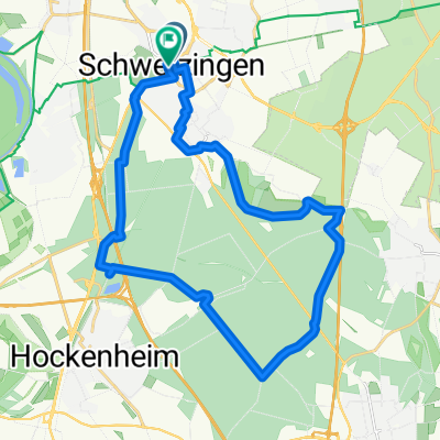
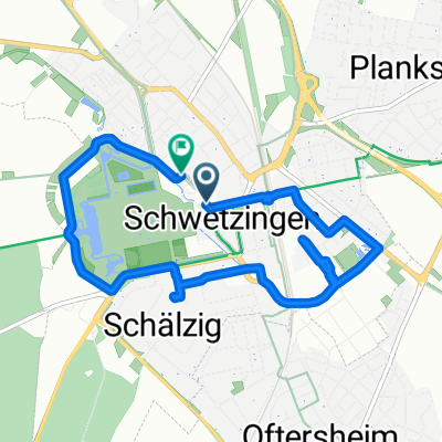
21km
A cycling route starting in Schwetzingen, Baden-Wurttemberg, Germany.
Overview
About this route
Plankstadt, Friedrichsfeld, Rheinau, Schwetzingen, Plankstadt
- -:--
- Duration
- 20.8 km
- Distance
- 31 m
- Ascent
- 31 m
- Descent
- ---
- Avg. speed
- ---
- Max. altitude
Route quality
Waytypes & surfaces along the route
Waytypes
Track
7.9 km
(38 %)
Quiet road
6.6 km
(32 %)
Surfaces
Paved
17 km
(82 %)
Unpaved
1.5 km
(7 %)
Asphalt
15.2 km
(73 %)
Paved (undefined)
1.9 km
(9 %)
Continue with Bikemap
Use, edit, or download this cycling route
You would like to ride 21km or customize it for your own trip? Here is what you can do with this Bikemap route:
Free features
- Save this route as favorite or in collections
- Copy & plan your own version of this route
- Sync your route with Garmin or Wahoo
Premium features
Free trial for 3 days, or one-time payment. More about Bikemap Premium.
- Navigate this route on iOS & Android
- Export a GPX / KML file of this route
- Create your custom printout (try it for free)
- Download this route for offline navigation
Discover more Premium features.
Get Bikemap PremiumFrom our community
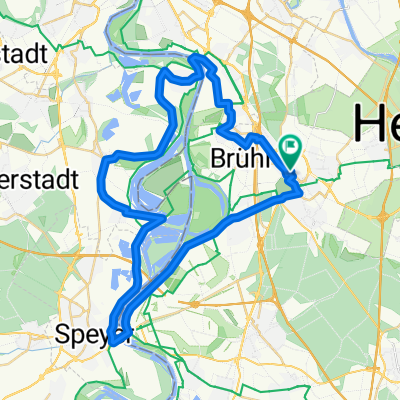
Other popular routes starting in Schwetzingen
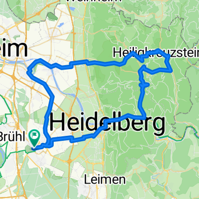 Schwtzngn Vorderheubach
- Distance
- 66.9 km
- Ascent
- 1,139 m
- Descent
- 1,138 m
- Location
- Schwetzingen, Baden-Wurttemberg, Germany
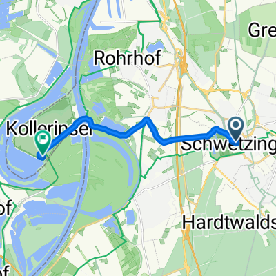 Schloßstraße nach Camping Kollersee
- Distance
- 9 km
- Ascent
- 16 m
- Descent
- 73 m
- Location
- Schwetzingen, Baden-Wurttemberg, Germany
 Luisenstraße 33, Schwetzingen nach Luisenstraße 35, Schwetzingen
- Distance
- 50 km
- Ascent
- 72 m
- Descent
- 73 m
- Location
- Schwetzingen, Baden-Wurttemberg, Germany
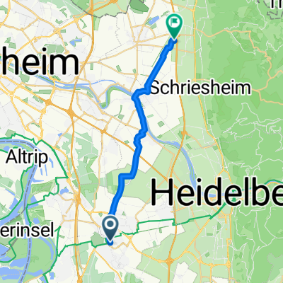 Friedrichstraße, Schwetzingen nach Goldbeckstraße, Hirschberg an der Bergstraße
- Distance
- 17.8 km
- Ascent
- 23 m
- Descent
- 30 m
- Location
- Schwetzingen, Baden-Wurttemberg, Germany
 Home - Sandhausen A5 und zurück
- Distance
- 26.4 km
- Ascent
- 99 m
- Descent
- 101 m
- Location
- Schwetzingen, Baden-Wurttemberg, Germany
 21km
21km- Distance
- 20.8 km
- Ascent
- 31 m
- Descent
- 31 m
- Location
- Schwetzingen, Baden-Wurttemberg, Germany
 Schloßstraße, Schwetzingen nach Schloßstraße, Schwetzingen
- Distance
- 7.5 km
- Ascent
- 33 m
- Descent
- 32 m
- Location
- Schwetzingen, Baden-Wurttemberg, Germany
 kleine Altriprunde
- Distance
- 48.3 km
- Ascent
- 63 m
- Descent
- 68 m
- Location
- Schwetzingen, Baden-Wurttemberg, Germany
Open it in the app