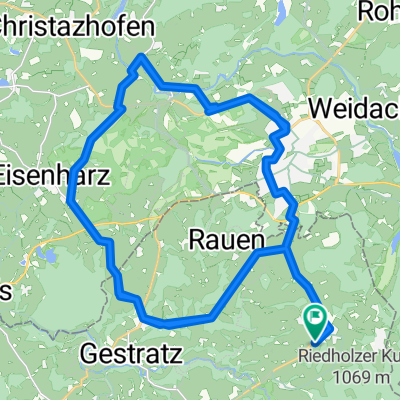
2. Etappe Bad Saulgau-Königssee: Riedholz-Füssen
- 83.7 km
- 627 m
- 572 m
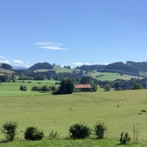
- Maierhöfen, Bavaria, Germany
A cycling route starting in Maierhöfen, Bavaria, Germany.
Overview
Stage 2 Bad Saulgau-Königssee: Oberstaufen-Füssen
created this 11 years ago
Route quality
Quiet road
38.5 km
(46 %)
Road
10.9 km
(13 %)
Paved
76.2 km
(91 %)
Unpaved
4.2 km
(5 %)
Asphalt
75.3 km
(90 %)
Gravel
1.7 km
(2 %)
Continue with Bikemap
You would like to ride 2. Etappe Bad Saulgau-Königssee: Riedholz-Füssen or customize it for your own trip? Here is what you can do with this Bikemap route:
Free trial for 3 days, or one-time payment. More about Bikemap Premium.
Discover more Premium features.
Get Bikemap PremiumFrom our community
Open it in the app