

Sassi di Rocca Malatina
A cycling route starting in Guiglia, Emilia-Romagna, Italy.
Overview
About this route
31/05/2014 con il gruppo dei Kicècè
- -:--
- Duration
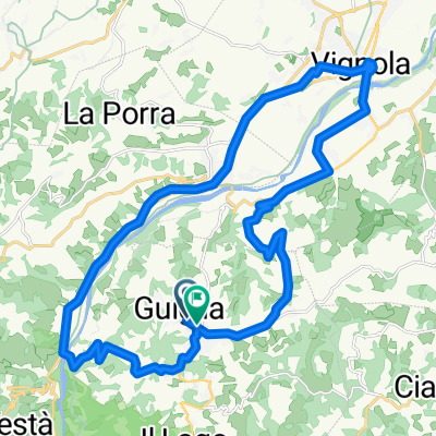
- 22.7 km
- Distance
- 634 m
- Ascent
- 637 m
- Descent
- ---
- Avg. speed
- ---
- Max. altitude
Continue with Bikemap
Use, edit, or download this cycling route
You would like to ride Sassi di Rocca Malatina or customize it for your own trip? Here is what you can do with this Bikemap route:
Free features
- Save this route as favorite or in collections
- Copy & plan your own version of this route
- Sync your route with Garmin or Wahoo
Premium features
Free trial for 3 days, or one-time payment. More about Bikemap Premium.
- Navigate this route on iOS & Android
- Export a GPX / KML file of this route
- Create your custom printout (try it for free)
- Download this route for offline navigation
Discover more Premium features.
Get Bikemap PremiumFrom our community
Other popular routes starting in Guiglia
 20150718_160743.gpx
- Distance
- 7.6 km
- Ascent
- 26 m
- Descent
- 335 m
- Location
- Guiglia, Emilia-Romagna, Italy
 sassi roccamalatina 2a
- Distance
- 22 km
- Ascent
- 580 m
- Descent
- 578 m
- Location
- Guiglia, Emilia-Romagna, Italy
 Festà - Ponte Sestaione
- Distance
- 70.2 km
- Ascent
- 1,855 m
- Descent
- 1,427 m
- Location
- Guiglia, Emilia-Romagna, Italy
 Sassi di Rocca Malatina
- Distance
- 22.7 km
- Ascent
- 634 m
- Descent
- 637 m
- Location
- Guiglia, Emilia-Romagna, Italy
 d) Ciclovia Parco dei Sassi di Roccamalatina
- Distance
- 24.9 km
- Ascent
- 756 m
- Descent
- 613 m
- Location
- Guiglia, Emilia-Romagna, Italy
 rondje guiglia
- Distance
- 29.1 km
- Ascent
- 402 m
- Descent
- 410 m
- Location
- Guiglia, Emilia-Romagna, Italy
 Sassi di Roccamalatina e Ponticelli
- Distance
- 33.2 km
- Ascent
- 738 m
- Descent
- 738 m
- Location
- Guiglia, Emilia-Romagna, Italy
 sassi - monte della riva
- Distance
- 33.6 km
- Ascent
- 693 m
- Descent
- 691 m
- Location
- Guiglia, Emilia-Romagna, Italy
Open it in the app