

020c Ingelheim - Stromberg - Schöneberg - Guldental - Ingelheim
A cycling route starting in Gau-Algesheim, Rhineland-Palatinate, Germany.
Overview
About this route
1
Start and finish location: Gate 1
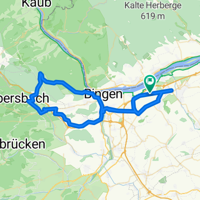
Ingelheim - Bingen Gaulsheim - Ockenheim - Büdesheim - Münster-Sarmsheim - Burg Layen - Waldlaubersheim - Genheim - Roth - Stromberg - Dörrebach - Forsthaus Neupfalz - Schöneberg - Hergenfeld - Windesheim - Guldental - Langenlonsheim - Laubenheim - Münster Sarmsheim - Bingen Büdesheim - Ockenheim - Bingen Gaulsheim - Ingelheim
- -:--
- Duration
- 73.3 km
- Distance
- 802 m
- Ascent
- 800 m
- Descent
- ---
- Avg. speed
- 487 m
- Max. altitude
Route quality
Waytypes & surfaces along the route
Waytypes
Road
31.5 km
43 %
Quiet road
7.3 km
10 %
Surfaces
Paved
57.9 km
(79 %)
Asphalt
54.3 km
74 %
Paved (undefined)
3.7 km
5 %
Undefined
15.4 km
21 %
Continue with Bikemap
Use, edit, or download this cycling route
You would like to ride 020c Ingelheim - Stromberg - Schöneberg - Guldental - Ingelheim or customize it for your own trip? Here is what you can do with this Bikemap route:
Free features
- Save this route as favorite or in collections
- Copy & plan your own version of this route
- Sync your route with Garmin or Wahoo
Premium features
Free trial for 3 days, or one-time payment. More about Bikemap Premium.
- Navigate this route on iOS & Android
- Export a GPX / KML file of this route
- Create your custom printout (try it for free)
- Download this route for offline navigation
Discover more Premium features.
Get Bikemap PremiumFrom our community
Other popular routes starting in Gau-Algesheim
- Von Ingelheim am Rhein bis Hofheim am Taunus0
- 46.1 km
- 188 m
- 146 m
- Gau-Algesheim, Rhineland-Palatinate, Germany
- 001c Ingelheim - Warmsroth - Ingelheim2
- 61.4 km
- 514 m
- 512 m
- Gau-Algesheim, Rhineland-Palatinate, Germany
- 003b Ingelheim - Lauschhütte - Roth - Ingelheim2
- 60.7 km
- 694 m
- 694 m
- Gau-Algesheim, Rhineland-Palatinate, Germany
- Im Hippel, Gau-Algesheim nach Im Hippel, Gau-Algesheim2
- 29 km
- 136 m
- 138 m
- Gau-Algesheim, Rhineland-Palatinate, Germany
- Im Hippel, Gau-Algesheim nach Im Hippel, Gau-Algesheim0
- 19.7 km
- 82 m
- 80 m
- Gau-Algesheim, Rhineland-Palatinate, Germany


Open it in the app