

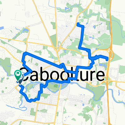
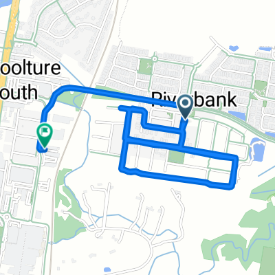
Caboolture to Redcliffe
A cycling route starting in Caboolture South, Queensland, Australia.
Overview
About this route
A long ride <span style="display: none;"> </span>between <span style="display: none;"> </span>Caboolture, Redcliffe, Sandgate and Strathpine. <div id="cke_pastebin" style="left: -1000px; top: 8px; width: 1px; height: 1px; overflow: hidden; position: absolute;"> </div>
- -:--
- Duration
- 93.8 km
- Distance
- 172 m
- Ascent
- 175 m
- Descent
- ---
- Avg. speed
- ---
- Max. altitude
Route quality
Waytypes & surfaces along the route
Waytypes
Road
17.8 km
(19 %)
Cycleway
16.9 km
(18 %)
Surfaces
Paved
89.1 km
(95 %)
Asphalt
75 km
(80 %)
Concrete
14.1 km
(15 %)
Undefined
4.7 km
(5 %)
Continue with Bikemap
Use, edit, or download this cycling route
You would like to ride Caboolture to Redcliffe or customize it for your own trip? Here is what you can do with this Bikemap route:
Free features
- Save this route as favorite or in collections
- Copy & plan your own version of this route
- Split it into stages to create a multi-day tour
- Sync your route with Garmin or Wahoo
Premium features
Free trial for 3 days, or one-time payment. More about Bikemap Premium.
- Navigate this route on iOS & Android
- Export a GPX / KML file of this route
- Create your custom printout (try it for free)
- Download this route for offline navigation
Discover more Premium features.
Get Bikemap PremiumFrom our community
Other popular routes starting in Caboolture South
 Caboolture to Redcliffe
- Distance
- 93.8 km
- Ascent
- 172 m
- Descent
- 175 m
- Location
- Caboolture South, Queensland, Australia
 Bellmere Road to Crebra Court
- Distance
- 23.8 km
- Ascent
- 64 m
- Descent
- 65 m
- Location
- Caboolture South, Queensland, Australia
 Jeffreys Street 14, Caboolture South to Jeffreys Street 14, Caboolture South
- Distance
- 74.9 km
- Ascent
- 354 m
- Descent
- 353 m
- Location
- Caboolture South, Queensland, Australia
 Caboolture Redcliffe Loop
- Distance
- 70.2 km
- Ascent
- 149 m
- Descent
- 149 m
- Location
- Caboolture South, Queensland, Australia
 2–28 Harvey Ct, Caboolture South to 1 Parer Cr, Morayfield
- Distance
- 3.7 km
- Ascent
- 38 m
- Descent
- 33 m
- Location
- Caboolture South, Queensland, Australia
 Caboolture-Sandgate Loop
- Distance
- 88.7 km
- Ascent
- 105 m
- Descent
- 107 m
- Location
- Caboolture South, Queensland, Australia
 Cattle Dr, Caboolture South to Dickson Rd, Caboolture South
- Distance
- 7.4 km
- Ascent
- 22 m
- Descent
- 19 m
- Location
- Caboolture South, Queensland, Australia
 Route to 26 Christine Street, Caboolture
- Distance
- 7.1 km
- Ascent
- 20 m
- Descent
- 19 m
- Location
- Caboolture South, Queensland, Australia
Open it in the app