

San Michele - Salurn - San Michele
A cycling route starting in San Michele all'Adige, Trentino-Alto Adige, Italy.
Overview
About this route
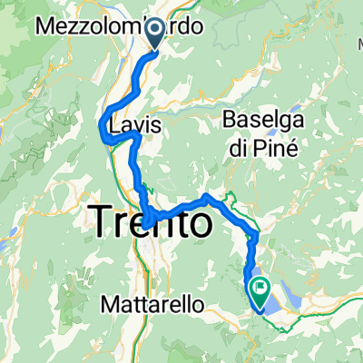
San Michele - Salurn - San Michele, loop course
- -:--
- Duration
- 44.8 km
- Distance
- 36 m
- Ascent
- 37 m
- Descent
- ---
- Avg. speed
- ---
- Max. altitude

Route quality
Waytypes & surfaces along the route
Waytypes
Cycleway
15.7 km
(35 %)
Quiet road
9 km
(20 %)
Surfaces
Paved
38.5 km
(86 %)
Unpaved
0.4 km
(1 %)
Asphalt
37.2 km
(83 %)
Paved (undefined)
1.3 km
(3 %)
Continue with Bikemap
Use, edit, or download this cycling route
You would like to ride San Michele - Salurn - San Michele or customize it for your own trip? Here is what you can do with this Bikemap route:
Free features
- Save this route as favorite or in collections
- Copy & plan your own version of this route
- Sync your route with Garmin or Wahoo
Premium features
Free trial for 3 days, or one-time payment. More about Bikemap Premium.
- Navigate this route on iOS & Android
- Export a GPX / KML file of this route
- Create your custom printout (try it for free)
- Download this route for offline navigation
Discover more Premium features.
Get Bikemap PremiumFrom our community
Other popular routes starting in San Michele all'Adige
 Hotel Cantaleone - Muse Trento
- Distance
- 36.7 km
- Ascent
- 102 m
- Descent
- 102 m
- Location
- San Michele all'Adige, Trentino-Alto Adige, Italy
 SS43 nach Via della Scuola
- Distance
- 43.1 km
- Ascent
- 409 m
- Descent
- 157 m
- Location
- San Michele all'Adige, Trentino-Alto Adige, Italy
 Giro del Vino 50 - Percorso SUD
- Distance
- 36.3 km
- Ascent
- 668 m
- Descent
- 666 m
- Location
- San Michele all'Adige, Trentino-Alto Adige, Italy
 01 San Michele - Trento - Rovereto
- Distance
- 49.8 km
- Ascent
- 70 m
- Descent
- 76 m
- Location
- San Michele all'Adige, Trentino-Alto Adige, Italy
 S.Michele, Egna, Pietralba
- Distance
- 84.9 km
- Ascent
- 1,291 m
- Descent
- 1,292 m
- Location
- San Michele all'Adige, Trentino-Alto Adige, Italy
 San Michele - Salurn - San Michele
- Distance
- 44.8 km
- Ascent
- 36 m
- Descent
- 37 m
- Location
- San Michele all'Adige, Trentino-Alto Adige, Italy
 San Michele all'Adige - Lago di Resia
- Distance
- 143.4 km
- Ascent
- 1,363 m
- Descent
- 53 m
- Location
- San Michele all'Adige, Trentino-Alto Adige, Italy
 T5 San Michael a.d.Etsch nach Trient
- Distance
- 19.3 km
- Ascent
- 78 m
- Descent
- 91 m
- Location
- San Michele all'Adige, Trentino-Alto Adige, Italy
Open it in the app