

Citytriathlon Dinkelsbühl 2014 (Radstrecke)
A cycling route starting in Dinkelsbühl, Bavaria, Germany.
Overview
About this route
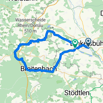
Crailsheimerstr. - old postal path - Ellwangerstraße - Segringen - Unterwinstetten - Gaisweiher - Wörtherstraße - new promenade This year, the city center will be bypassed - no cobblestones!
- -:--
- Duration
- 10.1 km
- Distance
- 91 m
- Ascent
- 91 m
- Descent
- ---
- Avg. speed
- ---
- Max. altitude

Route quality
Waytypes & surfaces along the route
Waytypes
Road
4.6 km
(46 %)
Quiet road
3.2 km
(32 %)
Surfaces
Paved
5.5 km
(54 %)
Asphalt
4.1 km
(41 %)
Paved (undefined)
1.3 km
(13 %)
Undefined
4.6 km
(46 %)
Continue with Bikemap
Use, edit, or download this cycling route
You would like to ride Citytriathlon Dinkelsbühl 2014 (Radstrecke) or customize it for your own trip? Here is what you can do with this Bikemap route:
Free features
- Save this route as favorite or in collections
- Copy & plan your own version of this route
- Sync your route with Garmin or Wahoo
Premium features
Free trial for 3 days, or one-time payment. More about Bikemap Premium.
- Navigate this route on iOS & Android
- Export a GPX / KML file of this route
- Create your custom printout (try it for free)
- Download this route for offline navigation
Discover more Premium features.
Get Bikemap PremiumFrom our community
Other popular routes starting in Dinkelsbühl
 3. Etappe Dinkelsbühl-Königsbrunn(121)
- Distance
- 121.6 km
- Ascent
- 467 m
- Descent
- 396 m
- Location
- Dinkelsbühl, Bavaria, Germany
 Route in Dinkelsbühl
- Distance
- 29.5 km
- Ascent
- 381 m
- Descent
- 364 m
- Location
- Dinkelsbühl, Bavaria, Germany
 Abendtour zum Abrackern
- Distance
- 18.4 km
- Ascent
- 103 m
- Descent
- 103 m
- Location
- Dinkelsbühl, Bavaria, Germany
 Dinkelsbühl Tour 10 Limes-Tour
- Distance
- 39.8 km
- Ascent
- 195 m
- Descent
- 198 m
- Location
- Dinkelsbühl, Bavaria, Germany
 3.1_Dinkelsbuehl - Donauwoerth
- Distance
- 74.2 km
- Ascent
- 147 m
- Descent
- 190 m
- Location
- Dinkelsbühl, Bavaria, Germany
 sato ve havuz
- Distance
- 46.1 km
- Ascent
- 396 m
- Descent
- 447 m
- Location
- Dinkelsbühl, Bavaria, Germany
 Trip zum Mönchstrother Freibad
- Distance
- 17.6 km
- Ascent
- 99 m
- Descent
- 99 m
- Location
- Dinkelsbühl, Bavaria, Germany
 Dinkelsbühl(Romant Strasse) nach Harburg/Schwaben
- Distance
- 60.6 km
- Ascent
- 366 m
- Descent
- 379 m
- Location
- Dinkelsbühl, Bavaria, Germany
Open it in the app