

Day 5 Outline
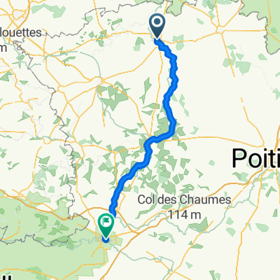
A cycling route starting in Thouars, Nouvelle-Aquitaine, France.
Overview
About this route
L'ile Bourdon Camping to Thouars
- -:--
- Duration
- 92 km
- Distance
- 278 m
- Ascent
- 303 m
- Descent
- ---
- Avg. speed
- ---
- Max. altitude
Route quality
Waytypes & surfaces along the route
Waytypes
Busy road
65 km
(71 %)
Quiet road
10.6 km
(12 %)
Surfaces
Paved
39.8 km
(43 %)
Unpaved
0.6 km
(<1 %)
Asphalt
39.1 km
(42 %)
Paving stones
0.7 km
(<1 %)
Continue with Bikemap
Use, edit, or download this cycling route
You would like to ride Day 5 Outline or customize it for your own trip? Here is what you can do with this Bikemap route:
Free features
- Save this route as favorite or in collections
- Copy & plan your own version of this route
- Split it into stages to create a multi-day tour
- Sync your route with Garmin or Wahoo
Premium features
Free trial for 3 days, or one-time payment. More about Bikemap Premium.
- Navigate this route on iOS & Android
- Export a GPX / KML file of this route
- Create your custom printout (try it for free)
- Download this route for offline navigation
Discover more Premium features.
Get Bikemap PremiumFrom our community
Other popular routes starting in Thouars
 Day 5 Outline
- Distance
- 92 km
- Ascent
- 278 m
- Descent
- 303 m
- Location
- Thouars, Nouvelle-Aquitaine, France
 Thouars to Niort 65 miles
- Distance
- 103.9 km
- Ascent
- 1,074 m
- Descent
- 1,148 m
- Location
- Thouars, Nouvelle-Aquitaine, France
 08-Thouars-Chalandray
- Distance
- 59.9 km
- Ascent
- 368 m
- Descent
- 306 m
- Location
- Thouars, Nouvelle-Aquitaine, France
 Vallée du Thouet
- Distance
- 87.4 km
- Ascent
- 445 m
- Descent
- 334 m
- Location
- Thouars, Nouvelle-Aquitaine, France
 tonton
- Distance
- 54.1 km
- Ascent
- 373 m
- Descent
- 243 m
- Location
- Thouars, Nouvelle-Aquitaine, France
 De Boulevard des Capucins 12, Thouars à Avenue Jacques Cœur 370, Poitiers
- Distance
- 73.1 km
- Ascent
- 477 m
- Descent
- 442 m
- Location
- Thouars, Nouvelle-Aquitaine, France
 Place Flandres-Dunkerque, Thouars to 22T Boulevard de la Meilleraye, Parthenay
- Distance
- 44 km
- Ascent
- 284 m
- Descent
- 216 m
- Location
- Thouars, Nouvelle-Aquitaine, France
 De 1 Rue du Château, Thouars à 1 Rue du Gué aux Loups, Louin
- Distance
- 28.4 km
- Ascent
- 238 m
- Descent
- 205 m
- Location
- Thouars, Nouvelle-Aquitaine, France
Open it in the app