

Basel-Brive
A cycling route starting in Basel, Canton of Basel-City, Switzerland.
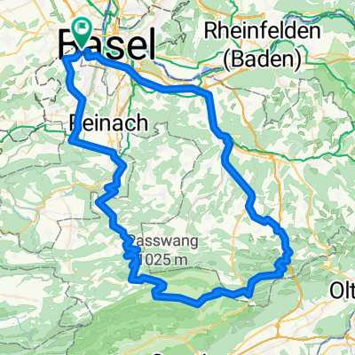
Overview
About this route
Fietstocht van Basel nr Brive la Gaillarde
- -:--
- Duration
- 1,070.4 km
- Distance
- 5,675 m
- Ascent
- 5,541 m
- Descent
- ---
- Avg. speed
- ---
- Max. altitude
Route quality
Waytypes & surfaces along the route
Waytypes
Road
345.4 km
(32 %)
Busy road
329.3 km
(31 %)
Surfaces
Paved
342.3 km
(32 %)
Unpaved
18.2 km
(2 %)
Asphalt
304.8 km
(28 %)
Paved (undefined)
29.5 km
(3 %)
Continue with Bikemap
Use, edit, or download this cycling route
You would like to ride Basel-Brive or customize it for your own trip? Here is what you can do with this Bikemap route:
Free features
- Save this route as favorite or in collections
- Copy & plan your own version of this route
- Split it into stages to create a multi-day tour
- Sync your route with Garmin or Wahoo
Premium features
Free trial for 3 days, or one-time payment. More about Bikemap Premium.
- Navigate this route on iOS & Android
- Export a GPX / KML file of this route
- Create your custom printout (try it for free)
- Download this route for offline navigation
Discover more Premium features.
Get Bikemap PremiumFrom our community
Other popular routes starting in Basel
 Basel-Hagethal-Oltige-Blochmont-Bourg-Därwil
- Distance
- 56.9 km
- Ascent
- 914 m
- Descent
- 855 m
- Location
- Basel, Canton of Basel-City, Switzerland
 85 km - Grellingen, Passwang, Langenbruck
- Distance
- 86.7 km
- Ascent
- 1,096 m
- Descent
- 1,096 m
- Location
- Basel, Canton of Basel-City, Switzerland
 find the 7
- Distance
- 47.9 km
- Ascent
- 590 m
- Descent
- 587 m
- Location
- Basel, Canton of Basel-City, Switzerland
 17.4.14 - 'Warme' Runde im Elsass
- Distance
- 58.8 km
- Ascent
- 286 m
- Descent
- 287 m
- Location
- Basel, Canton of Basel-City, Switzerland
 Elsass-Birstal-Rundfahrt
- Distance
- 76.8 km
- Ascent
- 880 m
- Descent
- 840 m
- Location
- Basel, Canton of Basel-City, Switzerland
 basel-badenweiler-notschrei-steinen-basel
- Distance
- 93.1 km
- Ascent
- 1,020 m
- Descent
- 1,020 m
- Location
- Basel, Canton of Basel-City, Switzerland
 Oberbölchen-Passwang-Nunningen
- Distance
- 98.1 km
- Ascent
- 1,370 m
- Descent
- 1,370 m
- Location
- Basel, Canton of Basel-City, Switzerland
 Jura Route
- Distance
- 308.1 km
- Ascent
- 5,724 m
- Descent
- 5,212 m
- Location
- Basel, Canton of Basel-City, Switzerland
Open it in the app