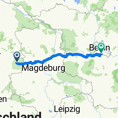
Königslutter am Elm - Rogätz
- 89.1 km
- 409 m
- 500 m
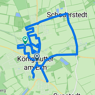
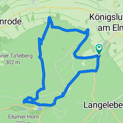
- Königslutter am Elm, Lower Saxony, Germany
A cycling route starting in Königslutter am Elm, Lower Saxony, Germany.
Overview
Ride from 4.6.14; mostly dry, brief showers towards the end, terrain mostly light soil, pure riding time 2:13:40, 18-16°
Brief route description:
From the Lutterspring car park, we rode over Drachenberg to the Reitlingstal and from there in a loop around and onto the Eilumer Horn. From there you ride several trail sections, including through the Hasenloch (40% downhill section) towards Kneitlingen. Via a developed forest path, the route climbs again from Südelm and later you reach Tetzelstein via a trail section. From Tetzelstein the track runs to Langeleben to the Elfentrail. This one, with partly angular course and some root sections, leads to small ponds and the Langeleben castle ruins and the spring house. Along a great trail parallel to the main road from Königslutter to Tetzelstein you reach the start point again. Over approx. 31 km with about 710 m of elevation, many trail sections are linked together.
The route was compiled by Shampoo (IBC).
created this 11 years ago
Route quality
Track
24 km
(78 %)
Path
5.2 km
(17 %)
Paved
2.8 km
(9 %)
Unpaved
27.4 km
(89 %)
Gravel
15.1 km
(49 %)
Ground
6.5 km
(21 %)
Route highlights
Singletrail, ca. 800m
Singletrial, ca. 400m
Trailabschnitt, ca.1,6 km zur Gastwirtschaft im Reitlingstal
steilere Abfahrt bis ca. 27 %
Singletrail, ca. 850m
schöner Trailabschnit entlang der Pferdekoppel mit super Blick auf das Reitlingstal
steile Auffahrtsrampe, max. 25 %, bei schlechten Untergrund ggf. Schiebepassage
Höchster Punkt 311 m ü.N.N.
Singletrail, mit Hasenloch, ca. 40 % Downhillpassage
Trailabschnitt, ca. 1,6 km
mehrere Trailpassagen, ca. 3 km
Trail zum Tetzelstein, ca.700m
Elfentraileinfahrt, sehr winkliger Kurs mit vielen Wurzelpassagen
Burgruine Langeleben
Quellhaus
mehrere Trailabschnitte zur Hauptstrasse
Toptrail Richtung Königslutter, ca. 3,2 km
Continue with Bikemap
You would like to ride Lutterspring-Reitlingstal-Eilumer Höhe-Tetzel-Langeleben or customize it for your own trip? Here is what you can do with this Bikemap route:
Free trial for 3 days, or one-time payment. More about Bikemap Premium.
Discover more Premium features.
Get Bikemap PremiumFrom our community
Open it in the app