

Runde Bayerische Wald, mit Runde um den Hohen Bogen
A cycling route starting in Rimbach, Bavaria, Germany.
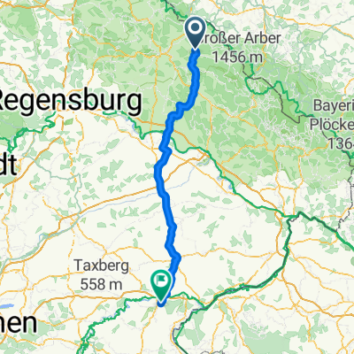
Overview
About this route
Ausweichrunde zur Arber Runde, mit Runde Hoher Bogen.
- -:--
- Duration
- 212.1 km
- Distance
- 1,849 m
- Ascent
- 1,911 m
- Descent
- ---
- Avg. speed
- ---
- Avg. speed
Route quality
Waytypes & surfaces along the route
Waytypes
Busy road
163.4 km
(77 %)
Quiet road
29.7 km
(14 %)
Surfaces
Paved
174.8 km
(82 %)
Unpaved
1.9 km
(<1 %)
Asphalt
174.8 km
(82 %)
Gravel
1.9 km
(<1 %)
Continue with Bikemap
Use, edit, or download this cycling route
You would like to ride Runde Bayerische Wald, mit Runde um den Hohen Bogen or customize it for your own trip? Here is what you can do with this Bikemap route:
Free features
- Save this route as favorite or in collections
- Copy & plan your own version of this route
- Split it into stages to create a multi-day tour
- Sync your route with Garmin or Wahoo
Premium features
Free trial for 3 days, or one-time payment. More about Bikemap Premium.
- Navigate this route on iOS & Android
- Export a GPX / KML file of this route
- Create your custom printout (try it for free)
- Download this route for offline navigation
Discover more Premium features.
Get Bikemap PremiumFrom our community
Other popular routes starting in Rimbach
 Tour B Arber-Radmarathon
- Distance
- 185.7 km
- Ascent
- 1,508 m
- Descent
- 1,508 m
- Location
- Rimbach, Bavaria, Germany
 Liebenstein 1
- Distance
- 34.5 km
- Ascent
- 701 m
- Descent
- 749 m
- Location
- Rimbach, Bavaria, Germany
 Haidstein-Wolframslinden-Runde
- Distance
- 17.3 km
- Ascent
- 421 m
- Descent
- 421 m
- Location
- Rimbach, Bavaria, Germany
 1991_Rimbach_R2_Vseruby
- Distance
- 48.9 km
- Ascent
- 594 m
- Descent
- 594 m
- Location
- Rimbach, Bavaria, Germany
 Kötzting und zruck
- Distance
- 16.3 km
- Ascent
- 473 m
- Descent
- 457 m
- Location
- Rimbach, Bavaria, Germany
 Drachensee-Runde
- Distance
- 26.5 km
- Ascent
- 379 m
- Descent
- 368 m
- Location
- Rimbach, Bavaria, Germany
 Rimbach-Altötting
- Distance
- 140 km
- Ascent
- 1,138 m
- Descent
- 1,218 m
- Location
- Rimbach, Bavaria, Germany
 1991_Rimbach_R1_Hoher Bogen
- Distance
- 30.4 km
- Ascent
- 764 m
- Descent
- 764 m
- Location
- Rimbach, Bavaria, Germany
Open it in the app