

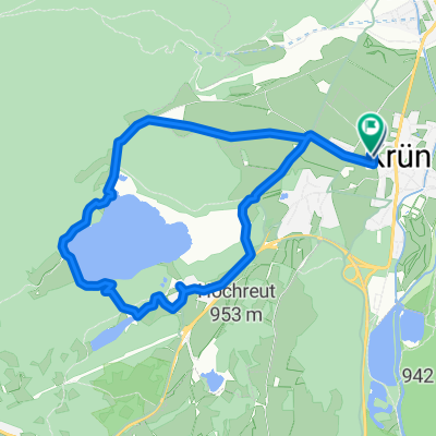
Isarhorn - Geisterklamm
A cycling route starting in Krün, Bavaria, Germany.
Overview
About this route
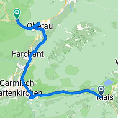
From the Isarhorn campsite, through Mittenwald (center) to the Leutascher Geisterklamm with a visit (2 hours walking through the gorge)
- -:--
- Duration
- 8.7 km
- Distance
- 152 m
- Ascent
- 44 m
- Descent
- ---
- Avg. speed
- ---
- Max. altitude

Continue with Bikemap
Use, edit, or download this cycling route
You would like to ride Isarhorn - Geisterklamm or customize it for your own trip? Here is what you can do with this Bikemap route:
Free features
- Save this route as favorite or in collections
- Copy & plan your own version of this route
- Sync your route with Garmin or Wahoo
Premium features
Free trial for 3 days, or one-time payment. More about Bikemap Premium.
- Navigate this route on iOS & Android
- Export a GPX / KML file of this route
- Create your custom printout (try it for free)
- Download this route for offline navigation
Discover more Premium features.
Get Bikemap PremiumFrom our community
Other popular routes starting in Krün
 Gerold - Wörgl 94 km
- Distance
- 93.6 km
- Ascent
- 1,120 m
- Descent
- 1,527 m
- Location
- Krün, Bavaria, Germany
- Gravel Deluxe
- Distance
- 91.6 km
- Ascent
- 1,116 m
- Descent
- 1,270 m
- Location
- Krün, Bavaria, Germany
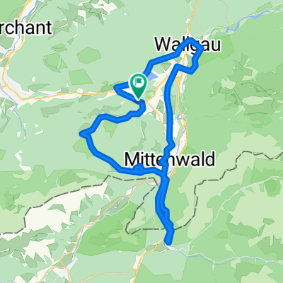
 Von Mittenwald ins Karwendelgebirge
- Distance
- 66.3 km
- Ascent
- 1,633 m
- Descent
- 1,633 m
- Location
- Krün, Bavaria, Germany
 Krottenkopfstraße 14, Krün nach Krottenkopfstraße 16, Krün
- Distance
- 9 km
- Ascent
- 193 m
- Descent
- 193 m
- Location
- Krün, Bavaria, Germany
 Fünf Seenrunde - durchs Karwendel
- Distance
- 50.4 km
- Ascent
- 424 m
- Descent
- 425 m
- Location
- Krün, Bavaria, Germany
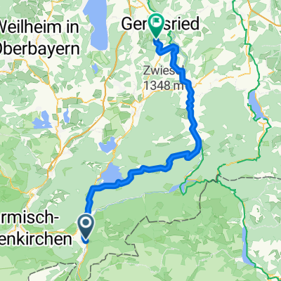 Am Horn, Mittenwald nach Königsdorf
- Distance
- 76.1 km
- Ascent
- 817 m
- Descent
- 1,102 m
- Location
- Krün, Bavaria, Germany
 Krottenkopfstraße nach Fleck
- Distance
- 36.8 km
- Ascent
- 193 m
- Descent
- 424 m
- Location
- Krün, Bavaria, Germany
 Von Klais bis Ettal
- Distance
- 26.2 km
- Ascent
- 410 m
- Descent
- 466 m
- Location
- Krün, Bavaria, Germany
Open it in the app