

Auf zum Dörtendorfer Berg
A cycling route starting in Sulza, Free State of Thuringia, Germany.
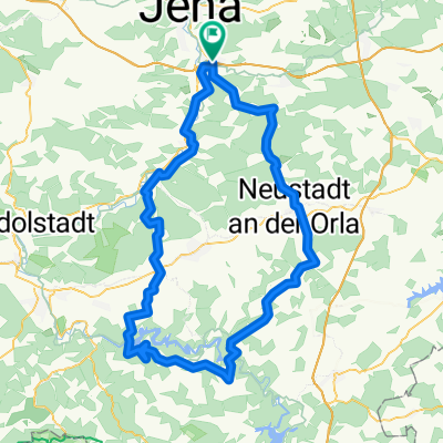
Overview
About this route
Sehr sehr wellig viele kleine giftige Stiche mit 9-13%
- -:--
- Duration
- 133.3 km
- Distance
- 1,491 m
- Ascent
- 1,481 m
- Descent
- ---
- Avg. speed
- 497 m
- Avg. speed
Route quality
Waytypes & surfaces along the route
Waytypes
Busy road
55.9 km
(42 %)
Road
28.6 km
(21 %)
Surfaces
Paved
80.7 km
(61 %)
Unpaved
5.1 km
(4 %)
Asphalt
78.1 km
(59 %)
Gravel
2.3 km
(2 %)
Continue with Bikemap
Use, edit, or download this cycling route
You would like to ride Auf zum Dörtendorfer Berg or customize it for your own trip? Here is what you can do with this Bikemap route:
Free features
- Save this route as favorite or in collections
- Copy & plan your own version of this route
- Split it into stages to create a multi-day tour
- Sync your route with Garmin or Wahoo
Premium features
Free trial for 3 days, or one-time payment. More about Bikemap Premium.
- Navigate this route on iOS & Android
- Export a GPX / KML file of this route
- Create your custom printout (try it for free)
- Download this route for offline navigation
Discover more Premium features.
Get Bikemap PremiumFrom our community
Other popular routes starting in Sulza
 Rund um die Jenaer Berge mit dem E-Bike
- Distance
- 54.7 km
- Ascent
- 550 m
- Descent
- 549 m
- Location
- Sulza, Free State of Thuringia, Germany
 Am Katzenstein 5, Jena nach Am Katzenstein 5, Jena
- Distance
- 38 km
- Ascent
- 345 m
- Descent
- 346 m
- Location
- Sulza, Free State of Thuringia, Germany
 Maua-Bockeda-Pürschütz-Seitenroda-Maua
- Distance
- 31.5 km
- Ascent
- 554 m
- Descent
- 554 m
- Location
- Sulza, Free State of Thuringia, Germany
 Chillige Abendtour durch die westlichen Berge Jenas
- Distance
- 49.9 km
- Ascent
- 469 m
- Descent
- 459 m
- Location
- Sulza, Free State of Thuringia, Germany
 MTB Waldwege
- Distance
- 21.5 km
- Ascent
- 470 m
- Descent
- 480 m
- Location
- Sulza, Free State of Thuringia, Germany
 Talsperrenrunde kurz
- Distance
- 113.3 km
- Ascent
- 1,117 m
- Descent
- 1,117 m
- Location
- Sulza, Free State of Thuringia, Germany
 Einfache Fahrt in Schöps
- Distance
- 5.1 km
- Ascent
- 53 m
- Descent
- 50 m
- Location
- Sulza, Free State of Thuringia, Germany
 Trainingsrunde
- Distance
- 23.9 km
- Ascent
- 266 m
- Descent
- 245 m
- Location
- Sulza, Free State of Thuringia, Germany
Open it in the app