

Rundfahrt zu den vier böhmisch-vogtländischen Bismarcktürmen
A cycling route starting in Adorf, Saxony, Germany.
Overview
About this route
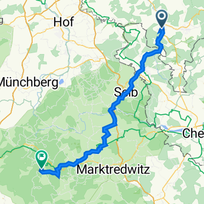
Beautiful tour to all the Bismarck towers in Vogtland and Bohemia via bike paths and little-used side roads. All towers are well restored and can be climbed for free, except for the Kemmlerturm. One should be well trained for this tour. Caution, the last part of the route from Oelsnitz to Adorf was traveled on the route of the still incomplete Elsterradweg. Some sections are just paths.
- -:--
- Duration
- 154.5 km
- Distance
- 1,003 m
- Ascent
- 1,003 m
- Descent
- ---
- Avg. speed
- ---
- Max. altitude
Route quality
Waytypes & surfaces along the route
Waytypes
Road
69.5 km
(45 %)
Quiet road
24.7 km
(16 %)
Surfaces
Paved
81.9 km
(53 %)
Unpaved
23.2 km
(15 %)
Asphalt
74.1 km
(48 %)
Ground
9.3 km
(6 %)
Continue with Bikemap
Use, edit, or download this cycling route
You would like to ride Rundfahrt zu den vier böhmisch-vogtländischen Bismarcktürmen or customize it for your own trip? Here is what you can do with this Bikemap route:
Free features
- Save this route as favorite or in collections
- Copy & plan your own version of this route
- Split it into stages to create a multi-day tour
- Sync your route with Garmin or Wahoo
Premium features
Free trial for 3 days, or one-time payment. More about Bikemap Premium.
- Navigate this route on iOS & Android
- Export a GPX / KML file of this route
- Create your custom printout (try it for free)
- Download this route for offline navigation
Discover more Premium features.
Get Bikemap PremiumFrom our community
Other popular routes starting in Adorf
 10.07.18 Adorf-Cunsdorf (7. Etappe)
- Distance
- 63.1 km
- Ascent
- 473 m
- Descent
- 574 m
- Location
- Adorf, Saxony, Germany
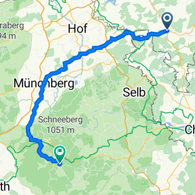
 Adorf - Keilberg - Adorf
- Distance
- 136.7 km
- Ascent
- 1,628 m
- Descent
- 1,629 m
- Location
- Adorf, Saxony, Germany
 Pfaffenlohweg 5, Adorf/Vogtland nach Gustav-Leutelt-Straße 9, Fichtelberg
- Distance
- 63.9 km
- Ascent
- 941 m
- Descent
- 691 m
- Location
- Adorf, Saxony, Germany
 Kammweg (Alternative) bei Leubetha
- Distance
- 0.9 km
- Ascent
- 48 m
- Descent
- 0 m
- Location
- Adorf, Saxony, Germany
 6 auf einen Streich - (Große vogtl.-böhm. Bädertour)
- Distance
- 216.6 km
- Ascent
- 1,171 m
- Descent
- 1,173 m
- Location
- Adorf, Saxony, Germany
 Tag 4
Tag 4- Distance
- 75.2 km
- Ascent
- 1,298 m
- Descent
- 1,123 m
- Location
- Adorf, Saxony, Germany
 Reise zum Mittelpunkt Europas
- Distance
- 125.7 km
- Ascent
- 1,136 m
- Descent
- 1,148 m
- Location
- Adorf, Saxony, Germany
 Feierabendrunde
- Distance
- 22.2 km
- Ascent
- 298 m
- Descent
- 297 m
- Location
- Adorf, Saxony, Germany
Open it in the app