

Test
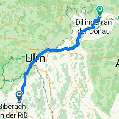
A cycling route starting in Maselheim, Baden-Wurttemberg, Germany.
Overview
About this route
Test
- -:--
- Duration
- 22.3 km
- Distance
- 137 m
- Ascent
- 138 m
- Descent
- ---
- Avg. speed
- ---
- Max. altitude
Route quality
Waytypes & surfaces along the route
Waytypes
Quiet road
11.4 km
(51 %)
Track
7.4 km
(33 %)
Surfaces
Paved
14.1 km
(63 %)
Unpaved
7.8 km
(35 %)
Asphalt
14.1 km
(63 %)
Gravel
4.5 km
(20 %)
Continue with Bikemap
Use, edit, or download this cycling route
You would like to ride Test or customize it for your own trip? Here is what you can do with this Bikemap route:
Free features
- Save this route as favorite or in collections
- Copy & plan your own version of this route
- Sync your route with Garmin or Wahoo
Premium features
Free trial for 3 days, or one-time payment. More about Bikemap Premium.
- Navigate this route on iOS & Android
- Export a GPX / KML file of this route
- Create your custom printout (try it for free)
- Download this route for offline navigation
Discover more Premium features.
Get Bikemap PremiumFrom our community
Other popular routes starting in Maselheim
 Test
Test- Distance
- 22.3 km
- Ascent
- 137 m
- Descent
- 138 m
- Location
- Maselheim, Baden-Wurttemberg, Germany
 Sandgrubenweg 12, Maselheim nach Sandgrubenweg 10, Maselheim
- Distance
- 26.3 km
- Ascent
- 240 m
- Descent
- 251 m
- Location
- Maselheim, Baden-Wurttemberg, Germany
 Meisenweg 15, Maselheim nach Weidachgasse 13, Vöhringen
- Distance
- 27.2 km
- Ascent
- 174 m
- Descent
- 249 m
- Location
- Maselheim, Baden-Wurttemberg, Germany
 Maselheim - Lutzingen
- Distance
- 97.1 km
- Ascent
- 249 m
- Descent
- 342 m
- Location
- Maselheim, Baden-Wurttemberg, Germany
 kólo wokół Biberach an der ris 20.10.2012
- Distance
- 60.3 km
- Ascent
- 236 m
- Descent
- 236 m
- Location
- Maselheim, Baden-Wurttemberg, Germany
 Äpfingen - Bad Buchau
- Distance
- 55.3 km
- Ascent
- 242 m
- Descent
- 237 m
- Location
- Maselheim, Baden-Wurttemberg, Germany
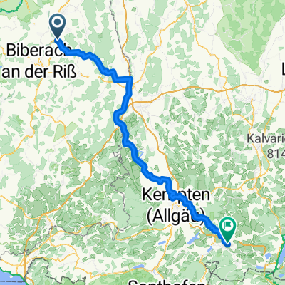 Von Maselheim bis Nesselwang
- Distance
- 109.7 km
- Ascent
- 1,284 m
- Descent
- 923 m
- Location
- Maselheim, Baden-Wurttemberg, Germany
 Zwischen Heggbacher Wald und langem Ghau
- Distance
- 60.9 km
- Ascent
- 397 m
- Descent
- 400 m
- Location
- Maselheim, Baden-Wurttemberg, Germany
Open it in the app