

River Ping Southern Route
A cycling route starting in Chiang Mai, Chiang Mai, Thailand.
Overview
About this route
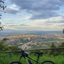
This trip begins in the southern city district of Chang Khlan and runs along the banks of river Ping to the border of Lamphun and back. First follow the road on the western bank leading south (downstream). The tarmac road is not very wide, but in good condition. From Saraphi on, there is considerably less traffic. If you go all the way down to the Lamphun border, the scenery becomes quite rural and you will pass through Longan orchards, fields, and villages. Turn around at Lamphun and follow the eastern bank north (upstream) back to Chiang Mai.<br /> <br /> There are several interesting spots for sight-seeing that potentially turn this into a full-day trip: 1. an optional detour to the city of Lamphun at the southernmost point (+1-2 hours), 2. an optional detour to the beautiful park of the century-old McKean rehabilitation centre (+0.5 hours), and 3. exploration of the ancient ruins and tempels of Wiang Kum Kam between the two outer ring roads (+1 hour).
(cloned from route 2325497)- -:--
- Duration
- 44.7 km
- Distance
- 24 m
- Ascent
- 25 m
- Descent
- ---
- Avg. speed
- ---
- Max. altitude
Route quality
Waytypes & surfaces along the route
Waytypes
Road
33.9 km
(76 %)
Quiet road
9.7 km
(22 %)
Surfaces
Paved
44.3 km
(99 %)
Asphalt
32.4 km
(73 %)
Concrete
6.9 km
(15 %)
Route highlights
Points of interest along the route
Point of interest after 19.6 km
Lamphun city
Point of interest after 34.8 km
McKean Rehabilitation Centre
Continue with Bikemap
Use, edit, or download this cycling route
You would like to ride River Ping Southern Route or customize it for your own trip? Here is what you can do with this Bikemap route:
Free features
- Save this route as favorite or in collections
- Copy & plan your own version of this route
- Sync your route with Garmin or Wahoo
Premium features
Free trial for 3 days, or one-time payment. More about Bikemap Premium.
- Navigate this route on iOS & Android
- Export a GPX / KML file of this route
- Create your custom printout (try it for free)
- Download this route for offline navigation
Discover more Premium features.
Get Bikemap PremiumFrom our community
Other popular routes starting in Chiang Mai
 MHS Loop
- Distance
- 533.7 km
- Ascent
- 5,294 m
- Descent
- 5,289 m
- Location
- Chiang Mai, Chiang Mai, Thailand
 Phuping Palace
- Distance
- 52.2 km
- Ascent
- 1,083 m
- Descent
- 1,098 m
- Location
- Chiang Mai, Chiang Mai, Thailand
 DoiSuthep
- Distance
- 49.9 km
- Ascent
- 1,107 m
- Descent
- 1,109 m
- Location
- Chiang Mai, Chiang Mai, Thailand
 Chiangmai U to Doi Su Thep view point
- Distance
- 18.1 km
- Ascent
- 404 m
- Descent
- 403 m
- Location
- Chiang Mai, Chiang Mai, Thailand
 Moderate Route in Chiang Mai
- Distance
- 7.4 km
- Ascent
- 21 m
- Descent
- 18 m
- Location
- Chiang Mai, Chiang Mai, Thailand
 Chiang Mai
- Distance
- 669.4 km
- Ascent
- 1,461 m
- Descent
- 1,461 m
- Location
- Chiang Mai, Chiang Mai, Thailand
 MTCM - ITT Huay Tung Thao Lake
- Distance
- 8.3 km
- Ascent
- 72 m
- Descent
- 78 m
- Location
- Chiang Mai, Chiang Mai, Thailand
 Reverse Samoeng Loop back via Bhubbing Palace
- Distance
- 116.8 km
- Ascent
- 2,847 m
- Descent
- 2,847 m
- Location
- Chiang Mai, Chiang Mai, Thailand
Open it in the app