

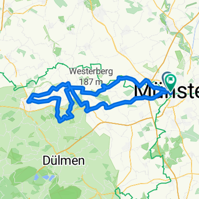
Baumbergekurztrip
A cycling route starting in Münster, North Rhine-Westphalia, Germany.
Overview
About this route
inspired by http://www.bikemap.net/route/28438
- -:--
- Duration
- 54.4 km
- Distance
- 207 m
- Ascent
- 208 m
- Descent
- ---
- Avg. speed
- 138 m
- Max. altitude

Route quality
Waytypes & surfaces along the route
Waytypes
Quiet road
26.6 km
(49 %)
Path
11.4 km
(21 %)
Surfaces
Paved
45.1 km
(83 %)
Asphalt
44.6 km
(82 %)
Paved (undefined)
0.5 km
(1 %)
Undefined
9.2 km
(17 %)
Continue with Bikemap
Use, edit, or download this cycling route
You would like to ride Baumbergekurztrip or customize it for your own trip? Here is what you can do with this Bikemap route:
Free features
- Save this route as favorite or in collections
- Copy & plan your own version of this route
- Sync your route with Garmin or Wahoo
Premium features
Free trial for 3 days, or one-time payment. More about Bikemap Premium.
- Navigate this route on iOS & Android
- Export a GPX / KML file of this route
- Create your custom printout (try it for free)
- Download this route for offline navigation
Discover more Premium features.
Get Bikemap PremiumFrom our community
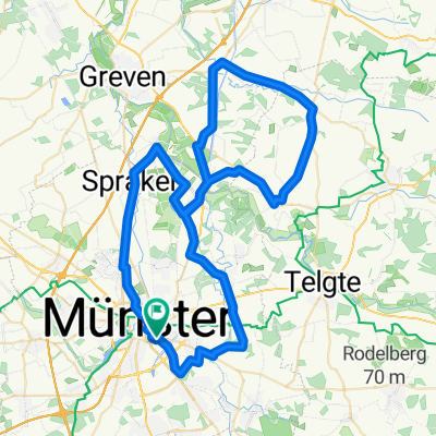
Other popular routes starting in Münster
 MS 01
MS 01- Distance
- 35.9 km
- Ascent
- 48 m
- Descent
- 46 m
- Location
- Münster, North Rhine-Westphalia, Germany
 Laerer Werseufer 7, Münster nach Laerer Werseufer 7, Münster
- Distance
- 19 km
- Ascent
- 29 m
- Descent
- 32 m
- Location
- Münster, North Rhine-Westphalia, Germany
 Münsterlandgiro 2010 90 Km
- Distance
- 93.8 km
- Ascent
- 531 m
- Descent
- 513 m
- Location
- Münster, North Rhine-Westphalia, Germany
 Kurze Münsterlandrunde
- Distance
- 38.7 km
- Ascent
- 109 m
- Descent
- 109 m
- Location
- Münster, North Rhine-Westphalia, Germany
 Münster über Werse und DEK
- Distance
- 36.4 km
- Ascent
- 47 m
- Descent
- 93 m
- Location
- Münster, North Rhine-Westphalia, Germany
 kleine sonntagsrund - 2 cafes und eine eisdiele
- Distance
- 23.4 km
- Ascent
- 52 m
- Descent
- 49 m
- Location
- Münster, North Rhine-Westphalia, Germany
 Erste Münsterland Giro.2011 Erkundungstour
- Distance
- 66.9 km
- Ascent
- 54 m
- Descent
- 54 m
- Location
- Münster, North Rhine-Westphalia, Germany
 Münster westlich
- Distance
- 24.3 km
- Ascent
- 71 m
- Descent
- 72 m
- Location
- Münster, North Rhine-Westphalia, Germany
Open it in the app