

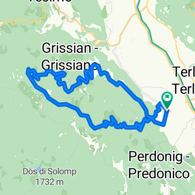
Andrian-Mendelpass-Gampenpass-Ultental
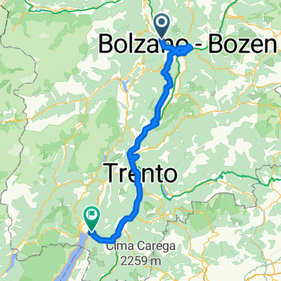
A cycling route starting in Andriano, Trentino-Alto Adige, Italy.
Overview
About this route
Andrian-Mendelpass-Gampenpass-Ultental-Andrian
- -:--
- Duration
- 103.9 km
- Distance
- 2,114 m
- Ascent
- 2,115 m
- Descent
- ---
- Avg. speed
- ---
- Max. altitude
Route quality
Waytypes & surfaces along the route
Waytypes
Busy road
81.2 km
(78 %)
Cycleway
9.6 km
(9 %)
Surfaces
Paved
97.7 km
(94 %)
Unpaved
0 km
(<1 %)
Asphalt
97.6 km
(94 %)
Paved (undefined)
0.1 km
(<1 %)
Continue with Bikemap
Use, edit, or download this cycling route
You would like to ride Andrian-Mendelpass-Gampenpass-Ultental or customize it for your own trip? Here is what you can do with this Bikemap route:
Free features
- Save this route as favorite or in collections
- Copy & plan your own version of this route
- Split it into stages to create a multi-day tour
- Sync your route with Garmin or Wahoo
Premium features
Free trial for 3 days, or one-time payment. More about Bikemap Premium.
- Navigate this route on iOS & Android
- Export a GPX / KML file of this route
- Create your custom printout (try it for free)
- Download this route for offline navigation
Discover more Premium features.
Get Bikemap PremiumFrom our community
Other popular routes starting in Andriano
 Andrian - Kaltern- Tramin- Kurtinig- Bozen- Andrian 77KM
- Distance
- 76.3 km
- Ascent
- 336 m
- Descent
- 336 m
- Location
- Andriano, Trentino-Alto Adige, Italy
 AXS Tour de Alps 2009 - Stage 10°
- Distance
- 206.8 km
- Ascent
- 5,224 m
- Descent
- 4,463 m
- Location
- Andriano, Trentino-Alto Adige, Italy
 Wolfsturm nachSt.Apollonia
- Distance
- 15.1 km
- Ascent
- 3,383 m
- Descent
- 3,430 m
- Location
- Andriano, Trentino-Alto Adige, Italy
 Andrian Berg 1 MTB
- Distance
- 22.4 km
- Ascent
- 1,101 m
- Descent
- 1,103 m
- Location
- Andriano, Trentino-Alto Adige, Italy
 Adrian-Mendelpass-Gampenjoch-Adrian
- Distance
- 81.5 km
- Ascent
- 1,697 m
- Descent
- 1,697 m
- Location
- Andriano, Trentino-Alto Adige, Italy
 2010_6_Via Claudia Augusta_Andrian - Nago
- Distance
- 141.1 km
- Ascent
- 452 m
- Descent
- 512 m
- Location
- Andriano, Trentino-Alto Adige, Italy
 Andrian... Montiggler See MTB 2
- Distance
- 24.2 km
- Ascent
- 746 m
- Descent
- 497 m
- Location
- Andriano, Trentino-Alto Adige, Italy
 Andrian-Mendelpass-Gampenpass-Ultental
- Distance
- 103.9 km
- Ascent
- 2,114 m
- Descent
- 2,115 m
- Location
- Andriano, Trentino-Alto Adige, Italy
Open it in the app